


BALTIMORE — Good Monday night!
The sunshine will go away tomorrow, and be replaced with clouds and rain. Your morning commute will be dry, but the commute home will be a wet one!
Here's what you need to know:
• Most rain occurs between Tuesday at 2pm until Wednesday morning at 2am.
• Rain amounts will be around a half inch with higher amounts south of Baltimore.
• There may be a few wet snowflakes that mix in across northern Baltimore County, Frederick, and Carroll counties on Tuesday.

Wednesday and Thursday will be cloudy and dry. Then we are looking ahead to our next rain maker which arrives Friday, and continues into Saturday morning.
Long term: Temperatures will be slightly above average for the next 10 days or so. There are early signs of a pattern switch up once we get past Thanksgiving and into the first few days of December. No sign of snow...but it looks like a big cool down could be underway!
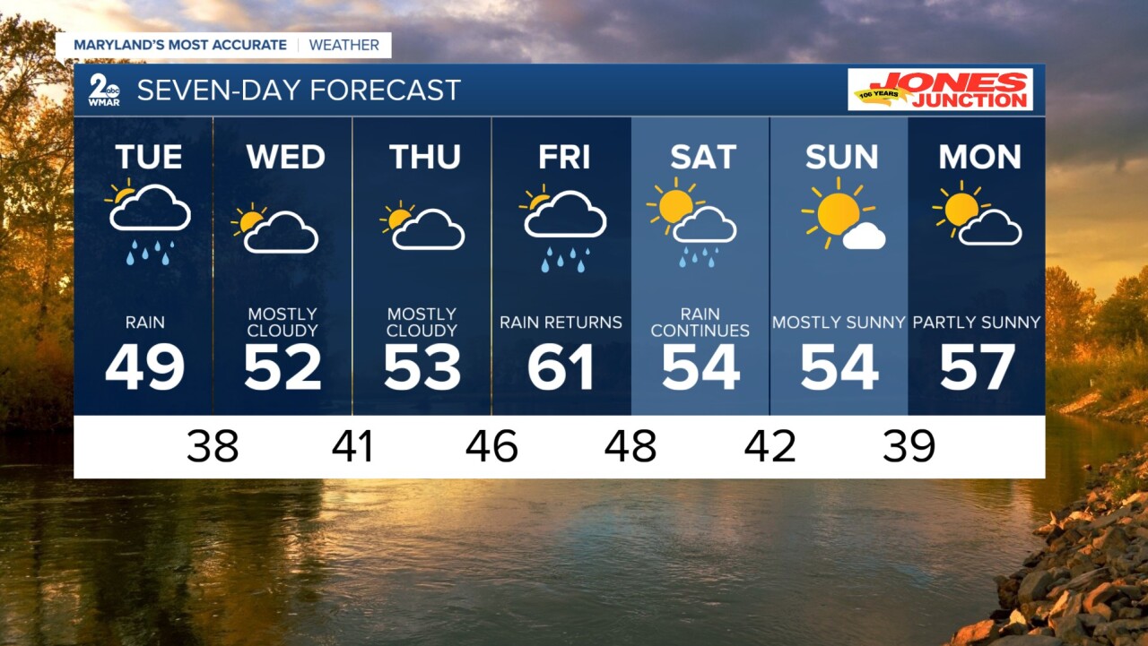
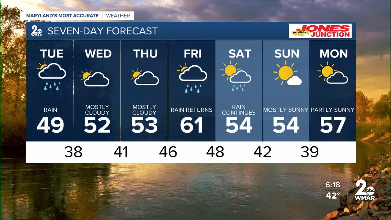
7 Day Forecast:
Tuesday A chance of rain. Increasing clouds, with a high near 48.
Tuesday Night Rain. Low around 38.
Wednesday Mostly cloudy, with a high near 50.
Wednesday Night Mostly cloudy, with a low around 41.
Thursday Cloudy, with a high near 53.
Thursday Night A chance of rain. Cloudy, with a low around 46.
Friday A chance of rain. Mostly cloudy, with a high near 62.
Friday Night Rain likely. Mostly cloudy, with a low around 48.
Saturday A chance of rain. Partly sunny, with a high near 58.
Saturday Night Partly cloudy, with a low around 42.
Sunday Mostly sunny, with a high near 58.
Sunday Night Partly cloudy, with a low around 39.
Monday Partly sunny, with a high near 51.

