


BALTIMORE — Good Saturday afternoon, I'm Meteorologist Dylan Robichaud.
I have good news and bad news regarding today's severe storms...
The good news is the tornado threat has shifted farther north into New England! Good for us, not good for them!
But we are still expecting severe storms capable of producing damaging winds 58+ mph and large hail.
The timing of the storms will be between 3pm and 8pm, with the greatest threat of severe storms being in northeast Maryland (Harford, Cecil, and Kent counties).
Showers will linger through sunrise on Sunday, with sunshine returning by Sunday afternoon.


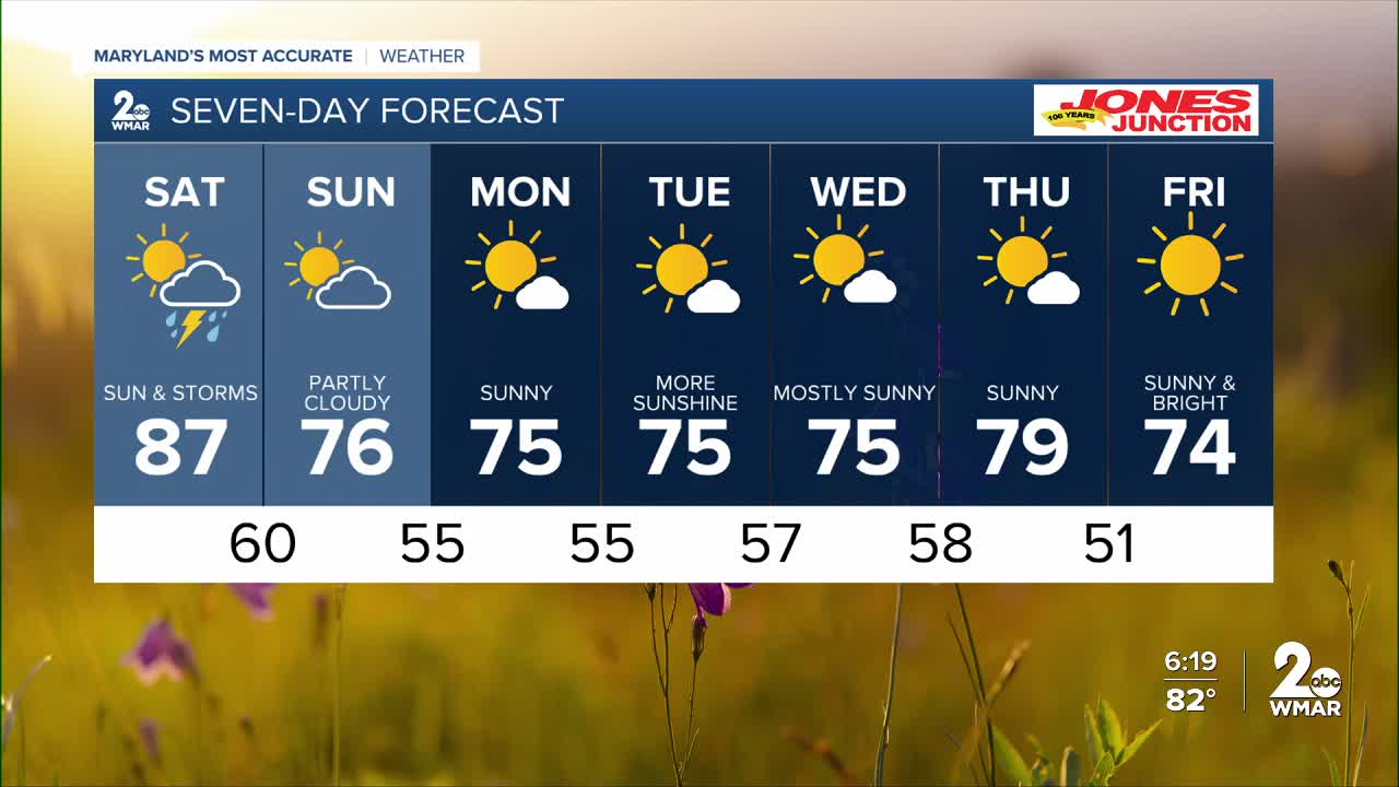
7 Day Forecast:
Saturday A slight chance of showers and possibly a thunderstorm. Some of the storms could produce heavy rainfall. High near 87.
Saturday night Showers and possibly a thunderstorm. Some of the storms could produce heavy rainfall. Low around 60.
Sunday Partly sunny, with a high near 76.
Sunday Night Mostly clear, with a low around 55.
Monday Sunny, with a high near 75.
Monday Night Mostly clear, with a low around 55.
Tuesday Sunny, with a high near 75.
Tuesday Night Partly cloudy, with a low around 57.
Wednesday Mostly sunny, with a high near 75.
Wednesday Night Partly cloudy, with a low around 58.
Thursday Mostly sunny, with a high near 79.
Thursday Night Mostly clear, with a low around 51.
Friday Sunny, with a high near 74.

