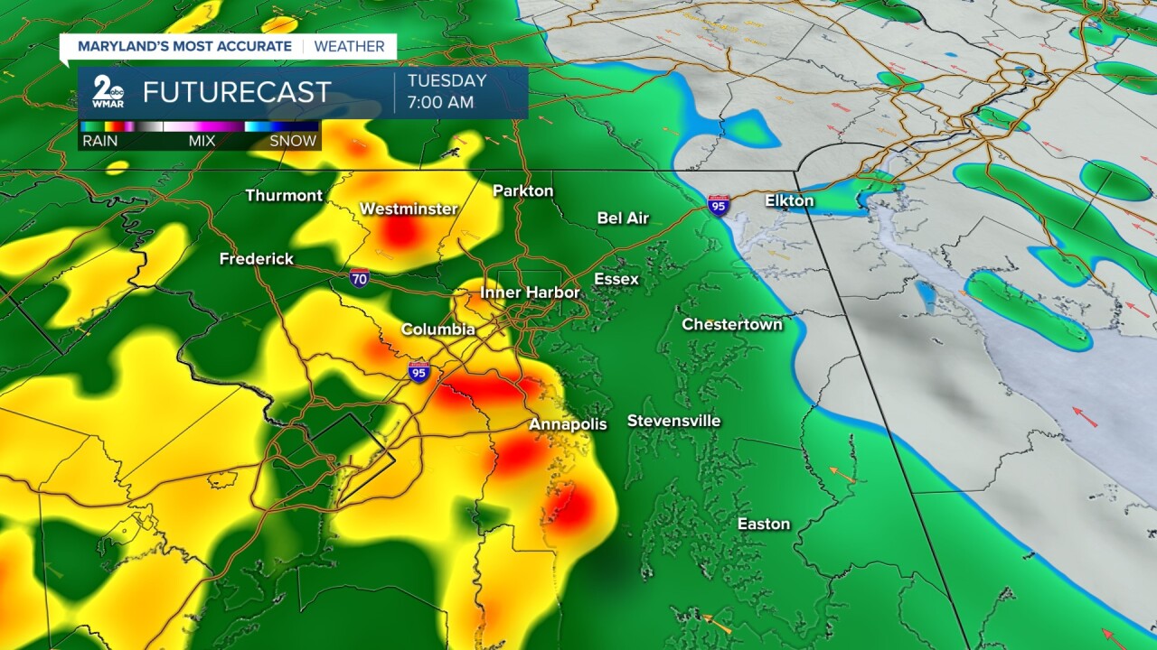


BALTIMORE — Grab the umbrella! We are facing an active week with plenty of rain chances. Monday start off dry. Showers fill in by the evening hours with most of the rain arriving overnight and into Tuesday. We could pick up between 1-2 inches of rain. Tuesday will be the wettest of the week with a rain chance everyday. There are some left over scattered showers each day with some dry time in between. Warmer weather is back by the end of the week and the thermometer climbs into the upper 80s. Scattered rain sticks around for the weekend, but it looks hit and miss.

Tonight Mostly cloudy, with a low around 58. East wind around 5 mph becoming calm in the evening.
Monday A chance of showers after 2pm. Partly sunny, with a high near 78. East wind 5 to 9 mph becoming south in the afternoon.
Monday Night Showers, mainly after 8pm. Low around 65. Southeast wind 5 to 7 mph.
Tuesday Showers. High near 73. Southeast wind 8 to 11 mph, with gusts as high as 22 mph.
Tuesday Night Showers and possibly a thunderstorm. Low around 63. East wind 7 to 11 mph, with gusts as high as 21 mph.
Wednesday Showers, with thunderstorms also possible after 2pm. High near 78.
Wednesday Night Showers likely, mainly before 2am. Mostly cloudy, with a low around 63.
Thursday A chance of showers, then showers likely and possibly a thunderstorm after 2pm. Partly sunny, with a high near 81.
Thursday Night Showers likely and possibly a thunderstorm before 8pm. Partly cloudy, with a low around 67.
Friday A chance of showers and thunderstorms after 2pm. Partly sunny, with a high near 89.
Friday Night A chance of showers and thunderstorms. Partly cloudy, with a low around 68.
Saturday A chance of showers and thunderstorms. Mostly sunny, with a high near 86.
Saturday Night A chance of showers and thunderstorms. Partly cloudy, with a low around 65.
Sunday A chance of showers, with a high near 81.

