

BALTIMORE — Merry Christmas Eve!
It will feel breezy this morning with wind gusts around 25-30 mph before they relax later today. Sunshine returns. Temperatures will trend milder, with highs near 50°. Christmas Day will be mild with highs in the low-50s, clouds will be plentiful, and a few spotty showers are possible, mostly to our southwest. Travel may be difficult on Friday afternoon/evening as a wintry mix of snow, sleet, and freezing rain is possible. This could lead to icy roads and sidewalks. Conditions clear out heading into Saturday before showers return on Sunday.

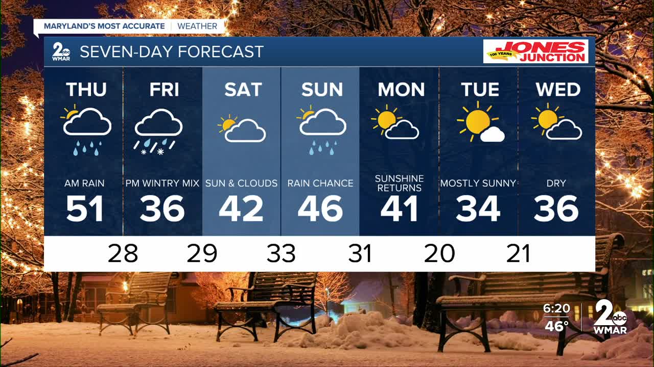
7 Day Forecast:
Today Mostly sunny, with a high near 50. Northwest wind 5-15 mph, with gusts as high as 25 mph.
Tonight Increasing clouds, with a low around 34. Calm wind.
Christmas Day A chance of rain. Mostly cloudy, with a high near 51.
Thursday Night Partly cloudy, with a low around 28.
Friday A chance of snow, freezing rain, and sleet. Cloudy, with a high near 36.
Friday Night Rain, freezing rain, and sleet. Low around 29.
Saturday Mostly cloudy, with a high near 42.
Saturday Night Mostly cloudy, with a low around 33.
Sunday Rain likely. Cloudy, with a high near 46.
Sunday Night Rain likely. Mostly cloudy, with a low around 31.
Monday Partly cloudy, with a high near 41.
Monday Night Partly cloudy, with a low around 20.
Tuesday Mostly sunny, with a high near 34.
Tuesday Night Partly cloudy, with a low around 21.
Wednesday Mostly sunny, with a high near 36.

