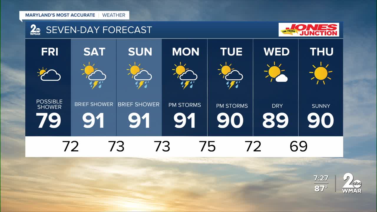


BALTIMORE — You asked for cooler weather, and Mother Nature will deliver tomorrow! High temperatures will only reach the lower 70s in the afternoon! That's a whopping 20 degrees cooler than Thursday! The trade off will be that conditions will be overcast through the day, and so if you are expecting a sunny day by the pool, you won't get it Friday!
Saturday will be cloudy in the morning, with increasing sunshine by the afternoon! There will be a slight chance of a pop-up storm on Saturday afternoon, then Sunday is trending drier.
Looking ahead...we maintain daily rain chances through Tuesday, then high pressure strengthens midweek, leading to dry and hot weather!

7 Day Forecast:
Friday A chance of showers and thunderstorms. Cloudy, with a high near 82.
Friday Night Showers likely and possibly a thunderstorm. Mostly cloudy, with a low around 72.
Saturday A chance of showers and thunderstorms. Mostly sunny, with a high near 91.
Saturday Night A chance of showers and thunderstorms. Mostly cloudy, with a low around 73.
Sunday A chance of showers and thunderstorms. Mostly sunny, with a high near 90.
Sunday Night A chance of showers and thunderstorms. Mostly cloudy, with a low around 73.
Monday Showers likely and possibly a thunderstorm. Partly sunny, with a high near 90.
Monday Night Showers and thunderstorms likely. Mostly cloudy, with a low around 75.
Tuesday Showers likely and possibly a thunderstorm. Partly sunny, with a high near 91.
Tuesday Night Showers and thunderstorms likely. Mostly cloudy, with a low around 72.
Wednesday Mostly sunny, with a high near 90.

