


BALTIMORE — Good Wednesday night!
With a high of 99°, we tied the all-time record today at BWI! The previous record was set back in 1997!
Thanks to increased cloud cover and storm chances, the next few days will be cooler with temperatures in the low 90s Thursday and lower 80s on Friday.
Afternoon showers and storms are expected Thursday. The Storm Prediction Center has issued a Marginal Risk (level 1 of 5) of severe weather. The timing will be from 1pm-9pm Thursday evening. Most of these storms will just contain heavy rain, thunder, and lightning. A few may contain hail and damaging wind. The tornado threat is very low on Thursday.
Afternoon shower and storm chances continue each afternoon for the next week or so!
Have a great night!


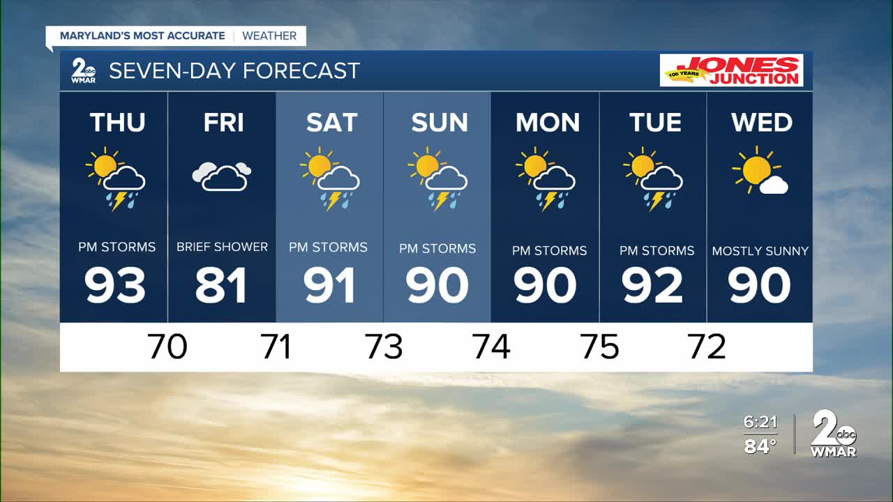
7 Day Forecast:
Thursday A chance of showers and possibly a thunderstorm. Mostly sunny, with a high near 93. Heat index values as high as 103.
Thursday Night Showers likely and possibly a thunderstorm. Mostly cloudy, with a low around 70.
Friday A chance of showers and thunderstorms. Mostly cloudy, with a high near 82.
Friday Night A chance of showers and thunderstorms. Mostly cloudy, with a low around 71.
Saturday A chance of showers and thunderstorms. Partly sunny, with a high near 90.
Saturday Night A chance of showers and thunderstorms. Mostly cloudy, with a low around 73.
Sunday A chance of showers and thunderstorms. Mostly sunny, with a high near 90.
Sunday Night A chance of showers and thunderstorms. Mostly cloudy, with a low around 74.
Monday A chance of showers and thunderstorms. Mostly sunny, with a high near 90.
Monday Night A chance of showers and thunderstorms. Mostly cloudy, with a low around 75.
Tuesday Showers likely and possibly a thunderstorm. Partly sunny, with a high near 92.

