


BALTIMORE — TGIF everyone!
Another hot and humid day with highs in the upper-80s. It will feel more like the low to mid-90s when you factor in the humidity. Easterly winds, added cloud cover, and increased rain chances today will help us out in the air quality department. Showers and isolated storms develop later this afternoon and evening. On and off rain showers are expected this weekend, with a few isolated thunderstorms on Saturday. Cooling down into the 70s on Father's Day. Showers linger into Monday with below normal temperatures, in the mid-70s. A warming trend ensues mid-week with highs rebounding back into the upper-80s and low-90s!
Stay hydrated!

7 Day Forecast:
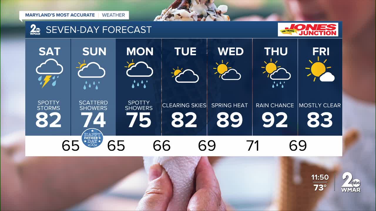
Friday A slight chance of showers and thunderstorms. Partly sunny, with a high near 88. Calm wind becoming east 5-10 mph.
Friday Night Showers likely and possibly a thunderstorm. Patchy fog. Otherwise, mostly cloudy, with a low around 69. Southeast wind around 5-10 mph.
Saturday A slight chance of showers. Mostly cloudy, with a high near 82.
Saturday Night A chance of showers and thunderstorms. Cloudy, with a low around 65.
Sunday A chance of showers and possibly a thunderstorm. Cloudy, with a high near 74.
Sunday Night Showers likely. Cloudy, with a low around 65.
Monday Showers likely. Mostly cloudy, with a high near 75.
Monday Night A chance of showers. Mostly cloudy, with a low around 66.
Tuesday A chance of showers. Mostly cloudy, with a high near 82.
Tuesday Night A chance of showers. Mostly cloudy, with a low around 69.
Wednesday A chance of showers and thunderstorms. Partly cloudy, with a high near 89.
Wednesday Night A chance of showers and thunderstorms. Mostly cloudy, with a low around 71.
Juneteenth A chance of showers and thunderstorms. Partly cloudy, with a high near 92.
Thursday Night A chance of showers and thunderstorms. Partly cloudy, with a low around 69.
Friday Sunny, with a high near 83.

