


BALTIMORE — Happy Friday!
It will be a cold start to the day with wake-up temperatures in the 30s and low-40s for many! Frost Advisories have been issued for Carroll and Frederick counties until 9AM. High temperatures will rise into the mid-60s today with ample sunshine! Temperatures will warm up this weekend, thanks to southerly winds. A cold front slides through Sunday evening, which will bring showers to the area around sunset. Moderate to heavy showers are possible into Monday morning with occasional gusty winds. The weather pattern gradually dries out on Monday afternoon. Another cold front will slide through towards the middle of the week, which could produce a few additional spotty showers.

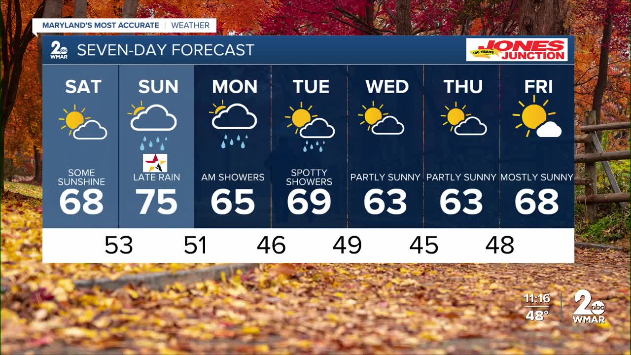
7 Day Forecast:
Today Sunny, with a high near 65. Northwest wind 5-10 mph.
Tonight Clear, with a low around 45. Calm wind.
Saturday Partly sunny, with a high near 68.
Saturday Night Mostly clear, with a low around 53.
Sunday A chance of showers. Partly sunny, with a high near 75.
Sunday Night Showers likely. Mostly cloudy, with a low around 51.
Monday A chance of showers. Partly sunny, with a high near 65.
Monday Night Mostly cloudy with a low around 46.
Tuesday A chance of showers. Partly cloudy, with a high near 69.
Tuesday Night Partly cloudy, with a low around 49.
Wednesday Partly sunny, with a high near 63.
Wednesday Night Mostly clear, with a low around 45.
Thursday Partly sunny, with a high near 63.
Thursday Night Partly cloudy, with a low around 48.
Friday Mostly sunny, with a high near 68.

