


BALTIMORE — After around two weeks of dry weather - some much needed rain moves into the region Thursday. Here's what we know!
• Storms roll through between 3-9 pm
• Rainfall up to half an inch
• Some storms will contain damaging wind and small hail

We catch a break from the severe weather on Friday (albeit a stray shower or storm is possible), then another front slides through Saturday bringing our next round of storms.

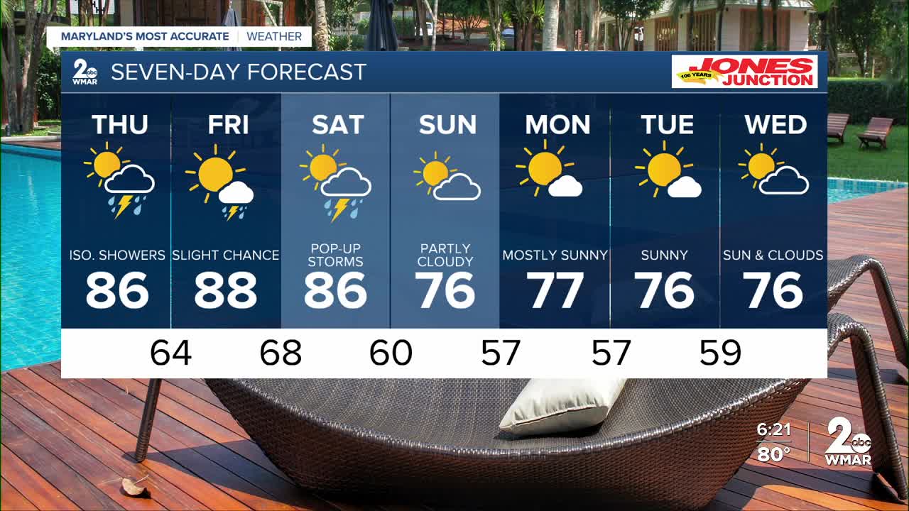
7 Day Forecast:
Thursday A chance of showers and thunderstorms. Mostly sunny, with a high near 86.
Thursday Night A chance of showers and thunderstorms. Mostly cloudy, with a low around 64.
Friday Sunny, with a high near 88.
Friday Night Mostly clear, with a low around 68.
Saturday A chance of showers. Mostly sunny, with a high near 86.
Saturday Night A chance of showers. Mostly cloudy, with a low around 60.
Sunday Mostly sunny, with a high near 76.
Sunday Night Mostly clear, with a low around 57.
Monday Sunny, with a high near 77.
Monday Night Partly cloudy, with a low around 57.
Tuesday Mostly sunny, with a high near 76.
Tuesday Night Partly cloudy, with a low around 59.
Wednesday Partly sunny, with a high near 76.

