


BALTIMORE — Good Thursday night! I'm Meteorologist Dylan Robichaud, and we've got quite a bit to talk about over the next few days!
First and foremost, frost and freeze alerts have been posted for western and northern Maryland Friday morning. If you have any sensitive plants, you'll want to cover them up!

Expect increasing clouds through the day Friday as our next storm system approaches from the south.
This system rolls in Saturday evening/night, with the worst impacts occurring Sunday. This will be a big rain and wind event, with winds gusting up to 45 mph across the Eastern Shore, and rain amounts between 1-2".
The precise timing of the rain will be ironed out in the next day or two as we get new data, but as of now, plan on a wet Sunday!


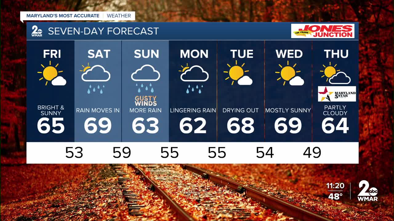
7 Day Forecast:
Friday Sunny, with a high near 66.
Friday Night Partly cloudy, with a low around 52.
Saturday A chance of showers. Mostly cloudy, with a high near 69.
Saturday Night Showers likely. Mostly cloudy, with a low around 57.
Sunday Showers likely. Mostly cloudy, with a high near 65.
Sunday Night Showers likely. Mostly cloudy, with a low around 52.
Columbus Day A chance of showers. Partly sunny, with a high near 64.
Monday Night A chance of showers. Mostly cloudy, with a low around 53.
Tuesday Mostly sunny, with a high near 70.
Tuesday Night Partly cloudy, with a low around 54.
Wednesday Mostly sunny, with a high near 70.
Wednesday Night Mostly clear, with a low around 49.
Thursday Sunny, with a high near 64.

