


BALTIMORE — Good Monday evening!
After a windy day today, we'll see winds subside a little tonight. It will still be windy on Tuesday, with gusts to 25 mph. Most of Tuesday will be dry, however, a front slides through Tuesday evening bringing another round of light showers.

Sunshine is expected Wednesday-Saturday.
A large dip in the upper-level jet stream will send temperatures tumbling down to the upper 30's and lower 40's late this week!

Looking ahead to the weekend: Saturday is trending dry with a few showers arriving during the Sunday to Monday time frame.

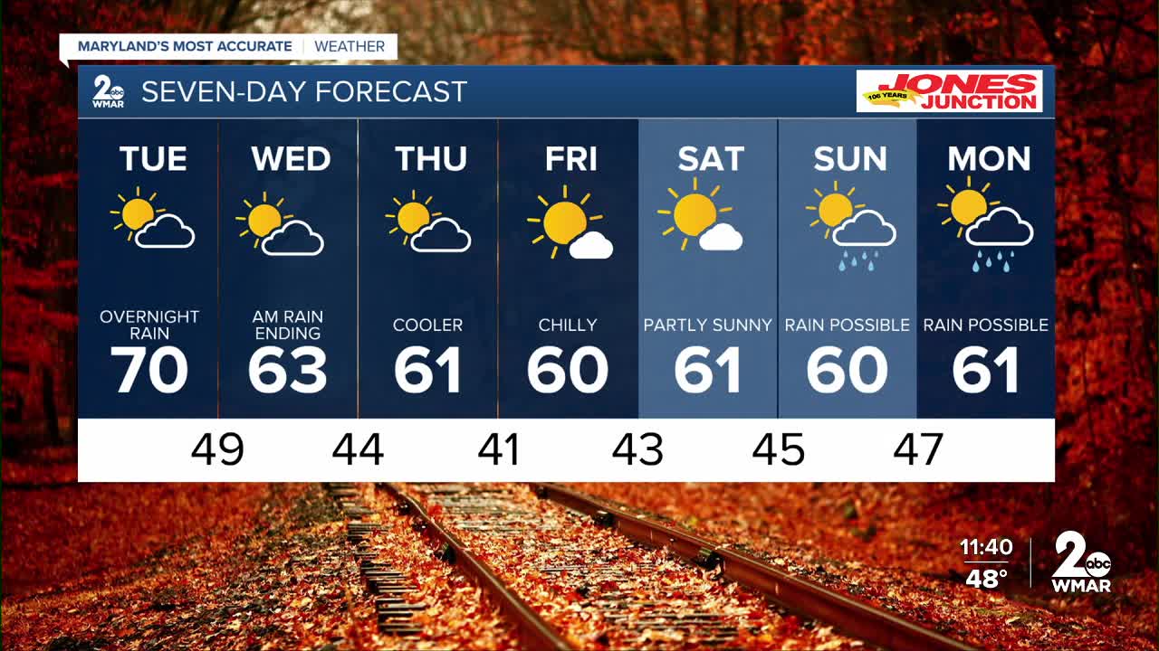
7 Day Forecast:
Tuesday Sunny, with a high near 70.
Tuesday Night A chance of showers. Mostly cloudy, with a low around 49.
Wednesday Sunny, with a high near 63.
Wednesday Night Mostly clear, with a low around 44.
Thursday Sunny, with a high near 61.
Thursday Night Mostly clear, with a low around 41.
Friday Sunny, with a high near 60.
Friday Night Partly cloudy, with a low around 43.
Saturday Partly cloudy, with a high near 61.
Saturday Night Mostly cloudy, with a low around 48.
Sunday Partly sunny, with a high near 63.
Sunday Night A chance of showers. Mostly cloudy, with a low around 51.
Monday Partly sunny, with a high near 52.

