


BALTIMORE — Good Monday night!
Today is our first day of meteorological winter, and Mother Nature will remind us of that Tuesday morning as our first snow potential of the year will arrive. Now, before you get excited, not all of you will get snow. Below is our current snow map, which shows the rain/snow line has pushed farther west.

Here is a breakdown of what you can expect:
- Precipitation begins between 3-5 AM.
- Snow/Sleet/Rain will transition to ALL rain between 7-9 AM.
- Heavy rain will finish between 1-3 PM.
- Snow accumulations most likely the closer to the PA state line you are.

Looking ahead: The sun returns on Wednesday, along with another frigid shot of cold air by Thursday and Friday.
We are tracking another coastal storm Friday night into Saturday - but the newest forecast models are downplaying it, and keeping most of the moisture south of Maryland.

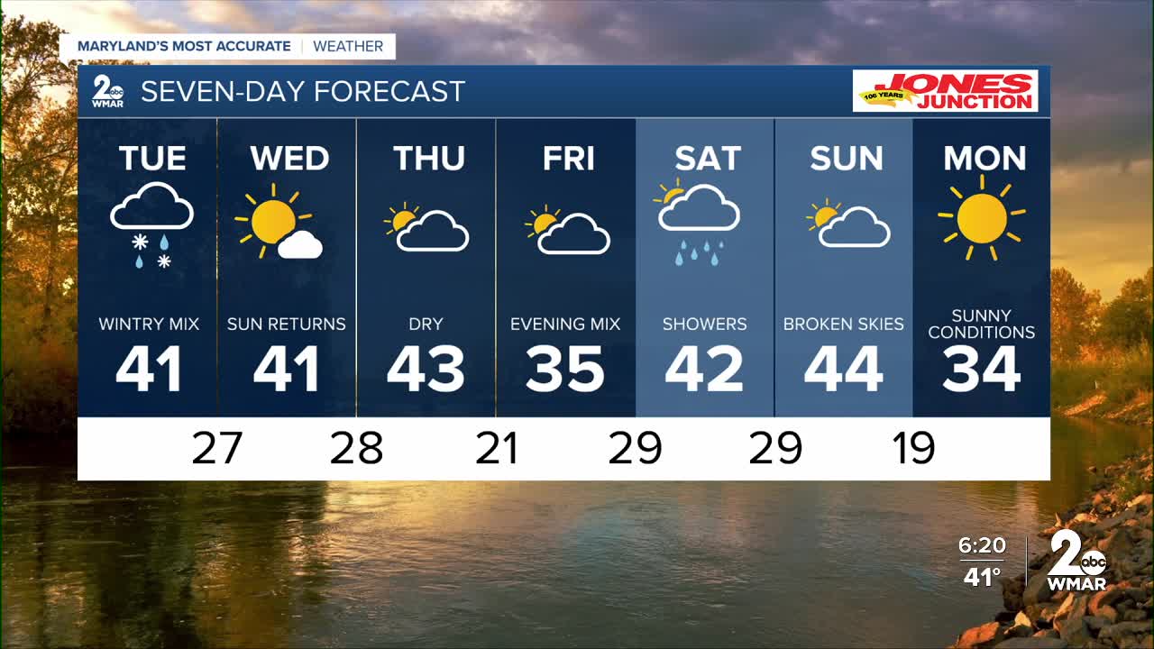
7 Day Forecast:
Tuesday Rain, possibly mixed with snow early. Rain during the afternoon. High near 41.
Tuesday Night Partly cloudy, with a low around 27.
Wednesday Sunny, with a high near 41.
Wednesday Night Mostly clear, with a low around 28.
Thursday Partly sunny, with a high near 43.
Thursday Night Partly cloudy, with a low around 21.
Friday Mostly cloudy, with a high near 35.
Friday Night Rain and possible snowflakes. Cloudy, with a low around 29.
Saturday A chance of rain. Mostly cloudy, with a high near 42.
Saturday Night A chance of rain. Mostly cloudy, with a low around 29.
Sunday Partly sunny, with a high near 44.
Sunday Night Mostly cloudy, with a low around 19.
Monday Mostly sunny, with a high near 34.

