



BALTIMORE — Happy Monday! Expect a mix of sun and clouds with gusty winds, upwards of 35 mph at times. Mostly sunny skies on Tuesday and Wednesday with highs in the mid to upper-60s.
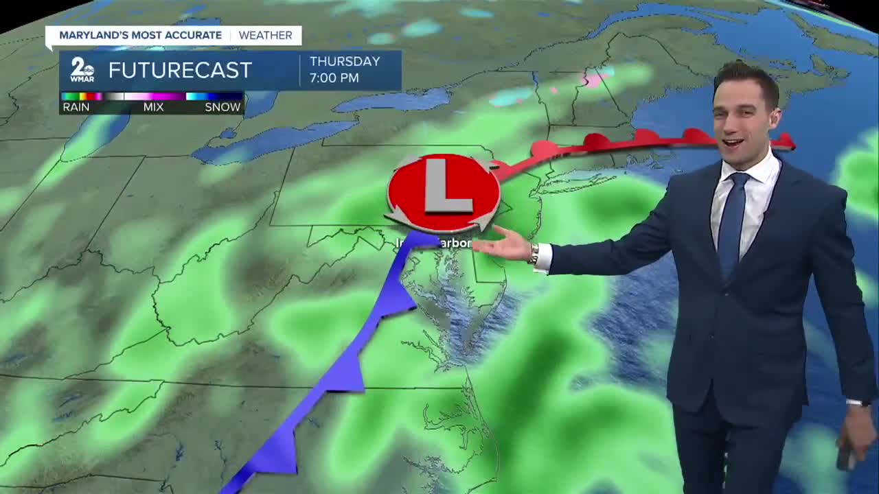
Big weather changes arrive Thursday and continue into Friday! A significant dip in the jet stream will allow a blast of cold air to spill into the eastern U.S., bringing us our first real taste of winterlike temperatures this season! I expect overnight lows to dip into the 30s in Baltimore, with daytime highs struggling to get out of the lower 50s. Areas northwest of the city could experience their first freeze of the season, potentially bringing the growing season to an end.
Meanwhile, as the polar and subtropical jet streams interact, a coastal storm is expected to develop Thursday. This system could bring rain to the I-95 corridor Thursday night into Friday, along with some light snow in the mountains of western Maryland!
Have a sunny day!
7 Day Forecast:
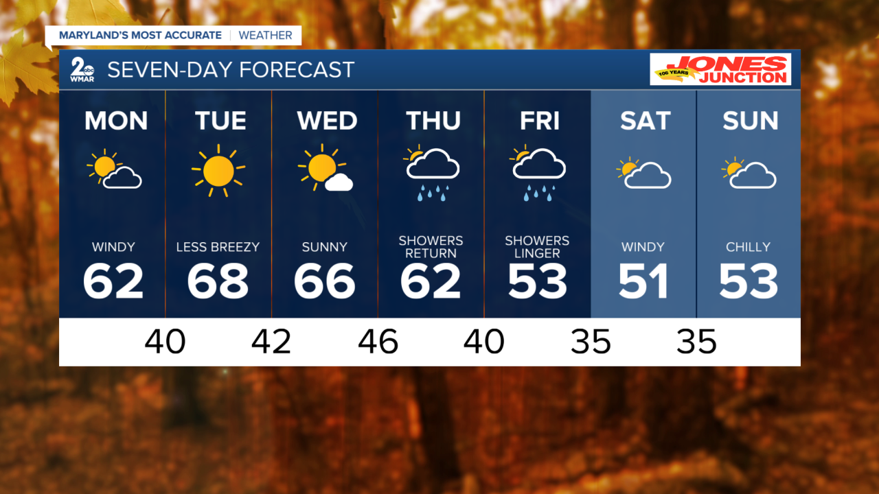
Monday Mostly sunny, with a high near 62. Breezy, with a west wind 15-25 mph, with gusts as high as 35 mph.
Monday Night Mostly clear, with a low around 40. Northwest wind 5-10 mph becoming calm after midnight.
Tuesday Sunny, with a high near 68.
Tuesday Night Clear, with a low around 42.
Veterans Day Sunny, with a high near 66.
Wednesday Night Partly cloudy, with a low around 46.
Thursday Rain likely. Mostly cloudy, with a high near 62.
Thursday Night Rain likely. Mostly cloudy, with a low around 40.
Friday Rain likely. Mostly cloudy, with a high near 53.
Friday Night A chance of rain. Mostly cloudy, with a low around 35.
Saturday Partly sunny, with a high near 51.
Saturday Night Partly cloudy, with a low around 35.
Sunday Mostly sunny, with a high near 53.

