

Spring-like air has dominated the region over the past couple of days! Temperatures have been 20-25° above normal across central Maryland. Who else is also LOVING this warmth?!
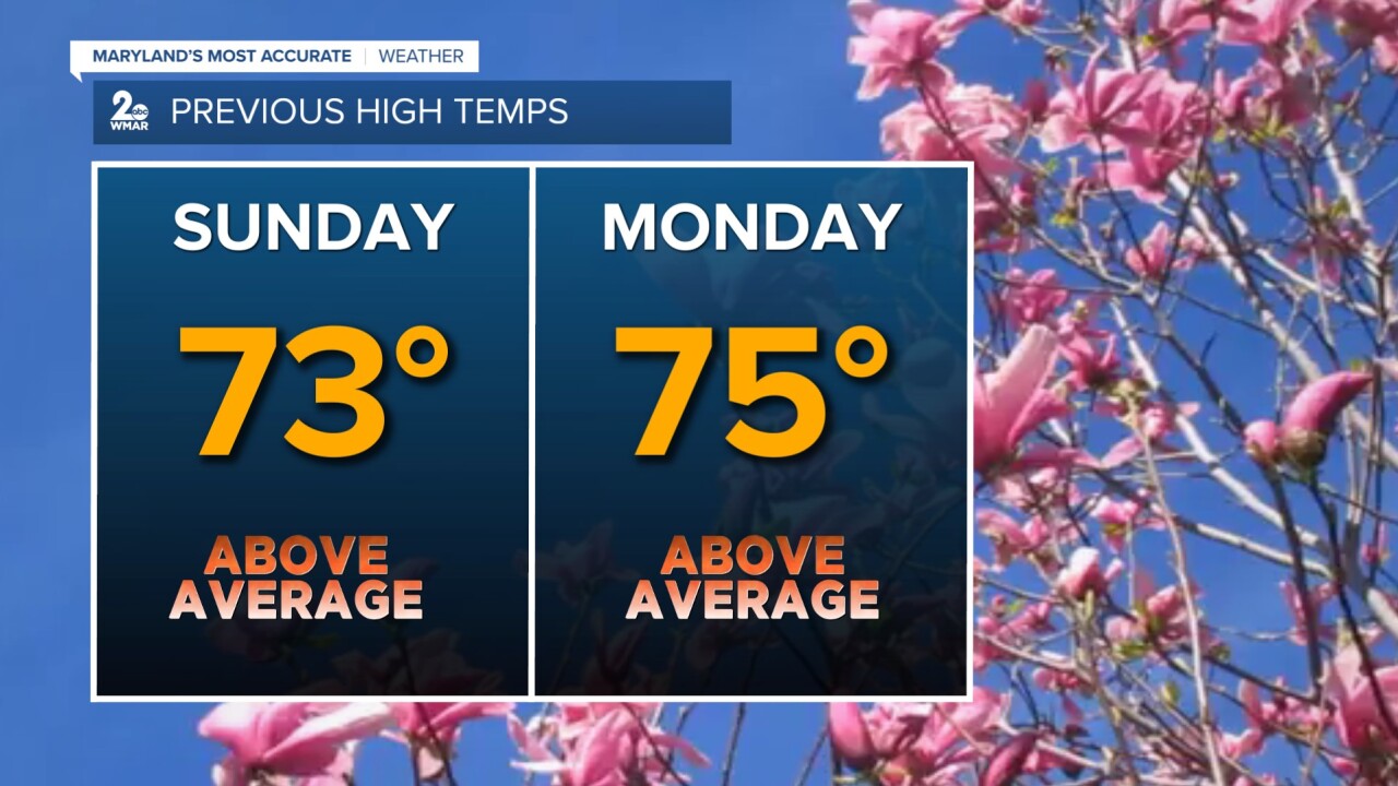
The record high temperature could be challenged today as temperatures rise well into the 70s once again! The old record high is 80° set back in 2016.

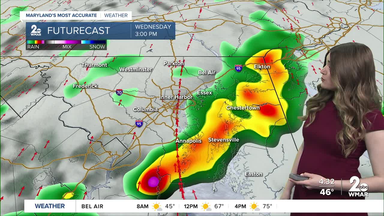
The warmth stick around on Wednesday, but there will be a threat for strong to severe storms during the afternoon and early-evening hours. One thing that could help stabilize the atmosphere would be extra clouds and spotty showers during the morning. However, model guidance shows some sunny breaks earlier in the day, which will help destabilize the environment as the cold front produces a line of convection. Wind shear is decent and energy levels will be elevated, which will support stronger updrafts.
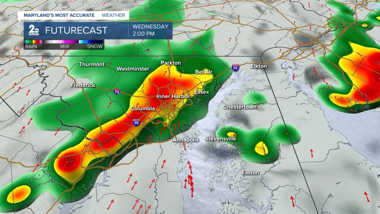
The Storm Prediction Center has the bulk of Maryland under a Slight Risk (level 2/5) as scattered storms could become more organized during the peak heating hours. All modes of severe weather are possible: strong gusty winds, heavy rainfall, hail, and even an isolated tornado. The areas is under a 2% tornado risk, with an even greater tornado risk (5%) across the western portion of the state.


Have your severe weather plans ready, in case you find yourself needing to act on them!

#StevieDanielsWX
Email: stevie.daniels@wmar.com
Facebook: www.facebook.com/StevieDanielsWX
X: www.twitter.com/StevieDanielsWX
Instagram & TikTok: stevie_daniels_

