


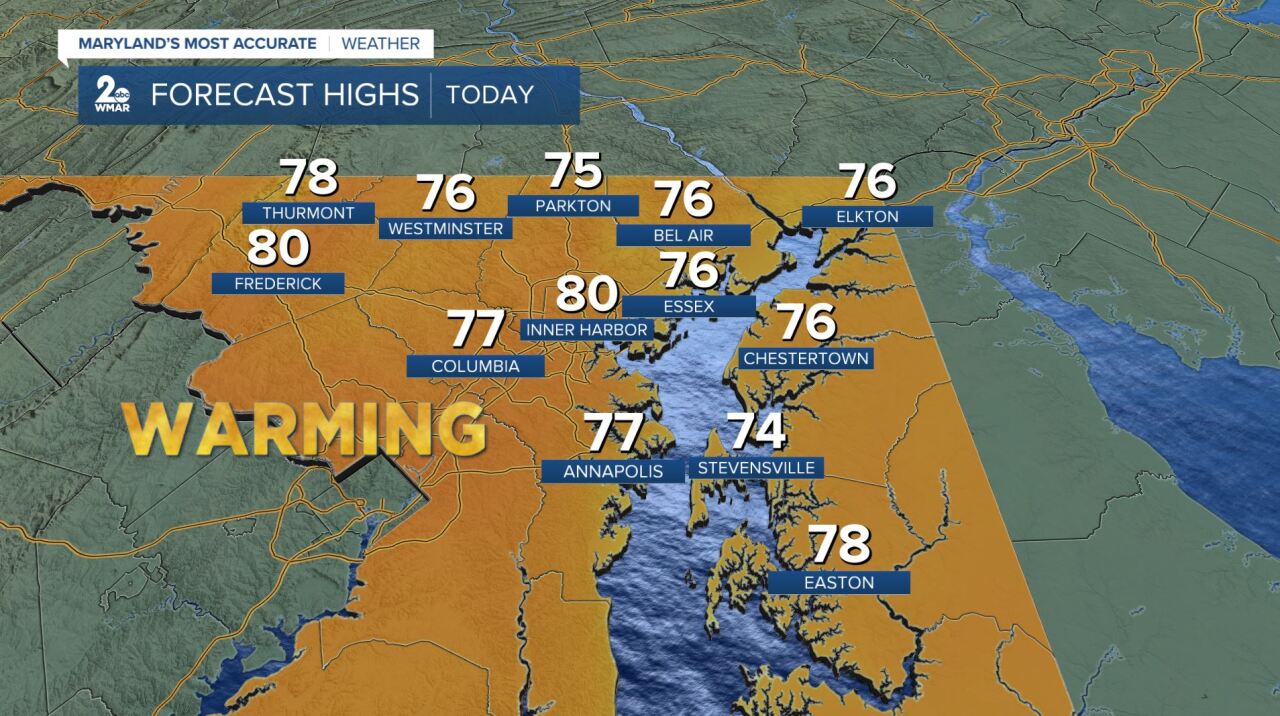
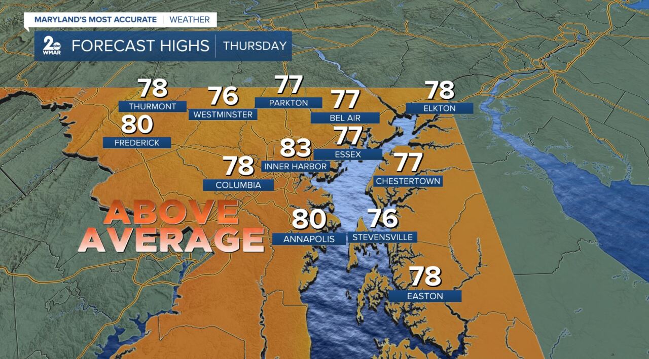
It seems like Summer is trying to hold on tight! High pressure builds in this evening, which will bring back noticeably more sunshine than we've seen in some time! South/northwest winds will help boost our temperatures above normal, in the lower-80s both today and Thursday!
Friday is looking to be the warmest out of the next 7 days as winds will increase out of the south and the sun will be showing itself! We have the potential to tie a record high of 86° that was set in 1989! Friday night into Saturday is where we switch gears a bit...

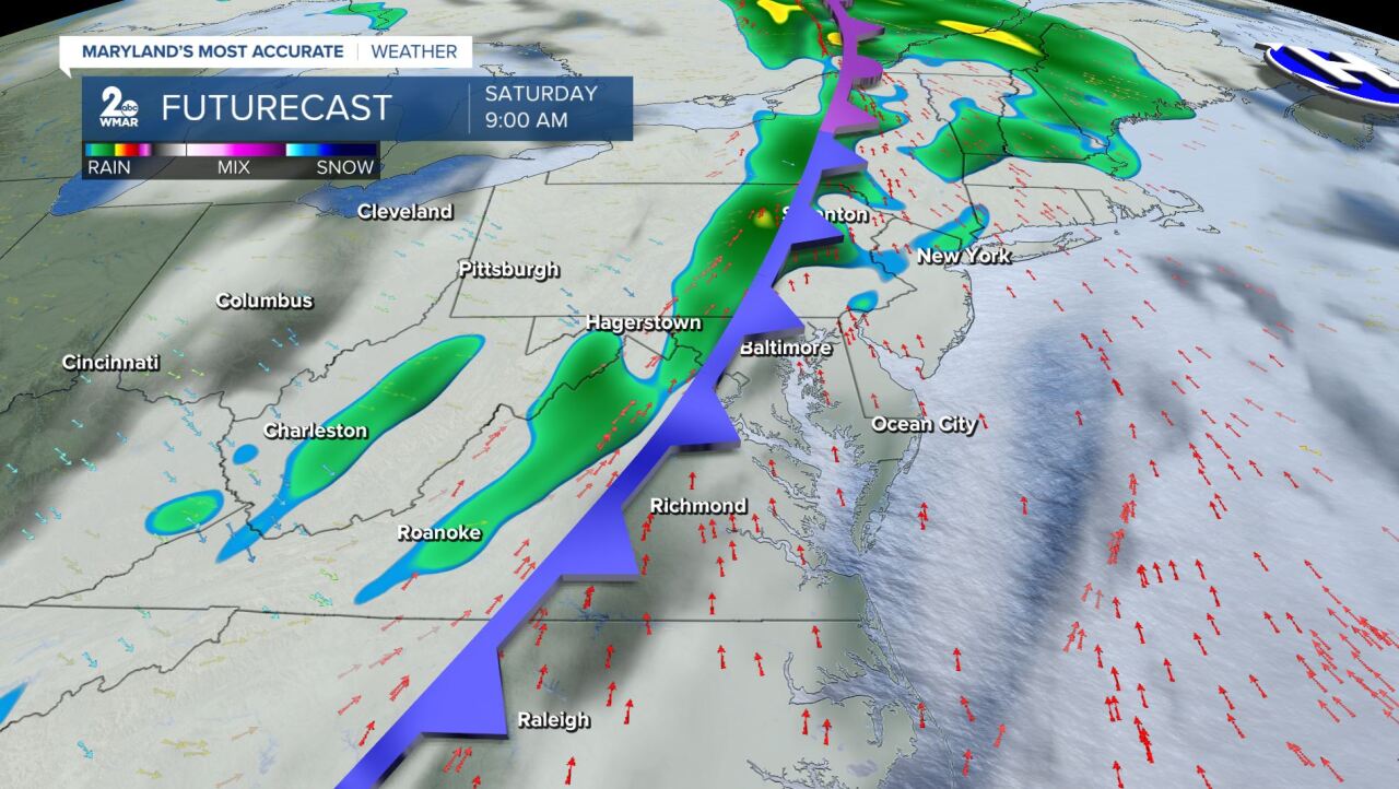
Temperatures are still expected to make it into the low-80s by early/mid-afternoon on Saturday before a potent cold front swings through from the west! This will likely generate some gusty showers across central Maryland and it will knock our temperatures down to more seasonal conditions for the second half of the weekend and early next week. Winds veer out of the south/southwest from 10-25 mph with wind gusts up to 35 mph at times on Saturday and Sunday. Winds will turn more northwesterly on Sunday. It will really be the battle of Summer & Fall!

#Staytuned
#StevieDanelsWX
www.facebook.com/StevieDanielsWX

