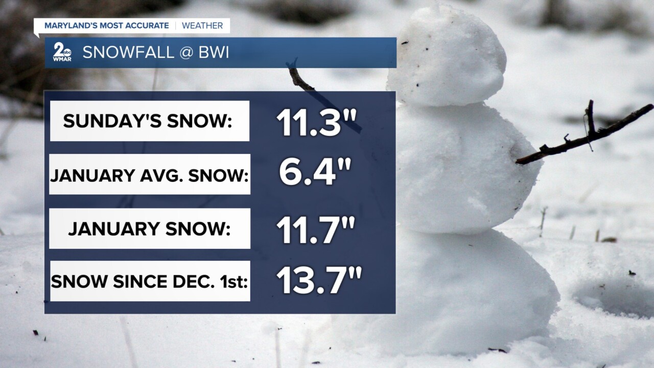


BALTIMORE — Most of the area saw between 6-12" of snowfall from the winter storm system that impacted the region on January 25th. Nearly 11.5" of snow was measured at BWI, which is the most snow we've seen from a single event in 10 years. This puts us above average in the snowfall department for the month of January, with a total of 11.7". The Baltimore area should normally see around 6.5" of snowfall during the entire month, but obviously the most recent winter storm gave us way more than that. Since the beginning of winter, 13.7" of snow has been recorded at BWI.
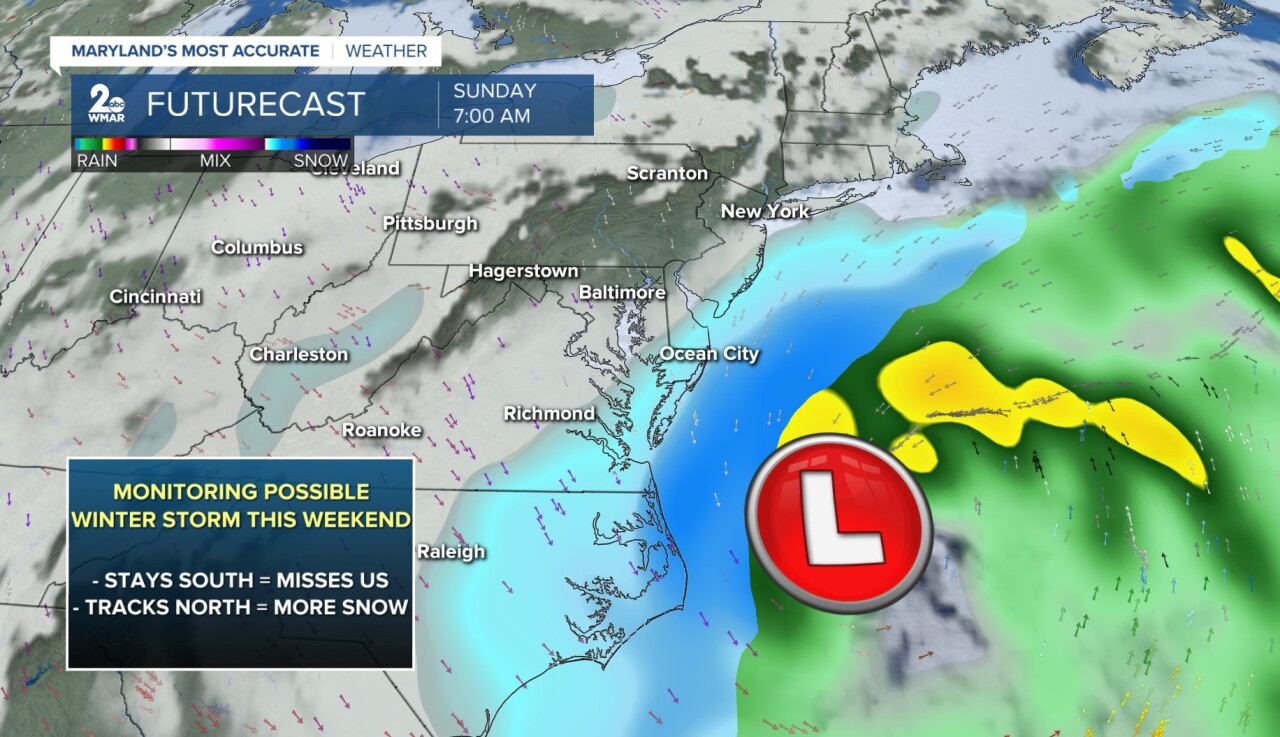
I know there is talk about another potential winter storm this weekend (January 31-February 1), but I want to state that there is still plenty of uncertainty with the exact track of this coastal storm. As of right now, most of the model guidance keeps the storm system out to sea, with some snow clipping parts of Delmarva. The patterns that we are seeing between computer models shows the snow would miss central Maryland completely if it stays more to our south and offshore. If it tracks more inland, then this would bring us our next round of accumulating snow. Maryland's Most Accurate Weather team will watch this system very closely as it evolves.
#StevieDanielsWX #Snow #January
Email: stevie.daniels@wmar.com
Facebook: www.facebook.com/StevieDanielsWX
X: www.twitter.com/StevieDanielsWX
Instagram & TikTok: stevie_daniels_

