

Hurricane Ian made landfall yesterday at 3:05 PM near Cayo Costa, Florida as a high-end category 4 hurricane. It is now a Tropical Storm.
Weakening is expected today as it travels over central and northeastern Florida today. It should emerge over the western Atlantic later today as a Topical Storm before it approaches the Georgia and South Carolina coastlines on Friday. Hurricane conditions are possible for these areas through Friday with life-threatening storm surge and considerable flooding expected.

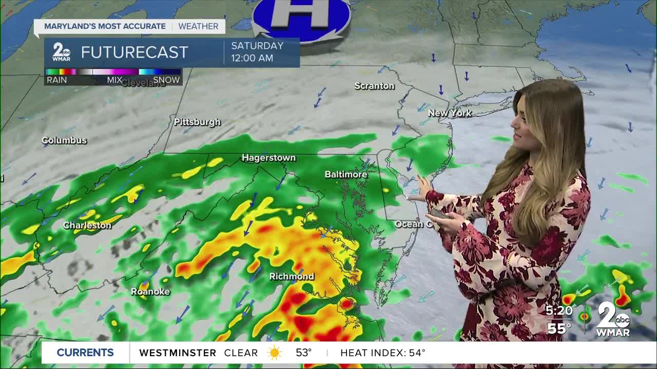
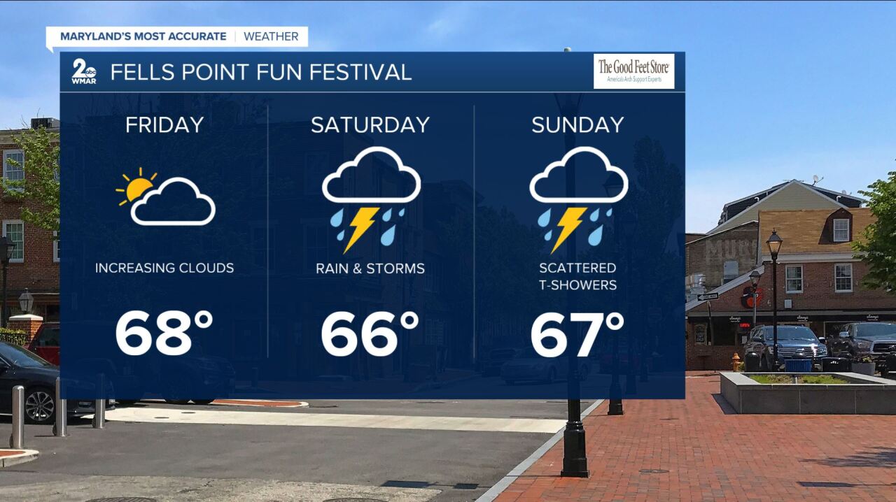
It will weaken to a Tropical Depression on Saturday morning, before becoming a remnant low Saturday evening. We will see the impacts here across the Mid-Atlantic region this weekend. Rain will move into southern Maryland late Friday night and will eventually overspread the area throughout the day on Saturday. A few rotating thunderstorms are possible as there may be enough wind shear in place. Tropical moisture will linger into early next week. Unfortunately, the Fells Point Fun Festival looks wet and soggy Saturday and Sunday.


Rainfall totals could shift, but it looks like most areas could see anywhere from 1-2" with locally higher amounts possible. Isolated instances of flooding cannot be ruled out.

#StayTuned #StaySafe #StayDry
#StevieDanielsWX
www.facebook.com/StevieDanielsWX
www.twitter.com/StevieDanielsWX
Instagram: stevie_daniels_

