


Today marks day five of this ongoing heatwave (three or more consecutive days with 90°+ temperatures). Major to extreme heat-related impacts are possible across the eastern half of the country. Most of Maryland could experience major impacts from the intense heat today, especially those who are without adequate cooling and hydration. Because of the Urban Heat Island effect, the metro regions, such as Baltimore and Washington DC could experience extreme heat-related impacts compared to nearby rural areas. This is due to their ability to trap and hold onto more heat.

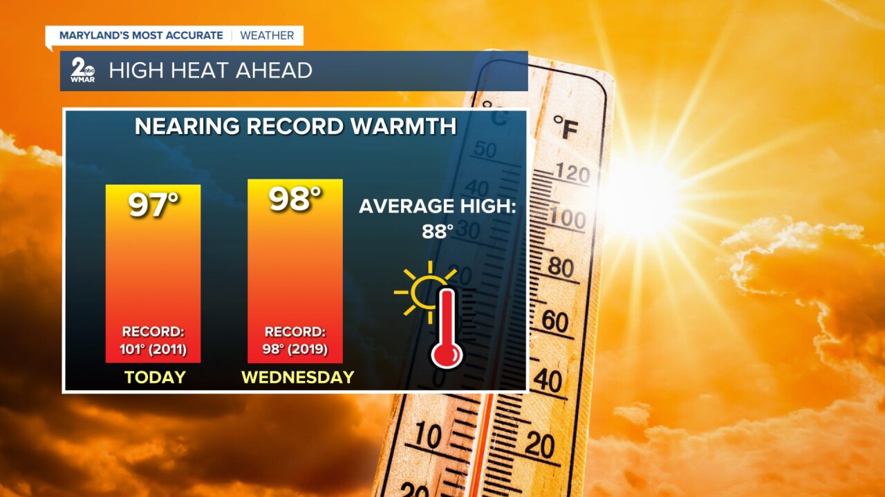
While it will feel like the lower-100s today, temperatures at BWI are not expected to reach record levels. However, there is a chance of tying the previous record high on Wednesday (98° set back in 2019). Wednesday is still projected to be the hottest day of the week. This is the type of heat that could lead to heat cramps, heat exhaustion, and heat stroke if you're not prioritizing your safety!
So far, there have been 12 days with 90°+ temperatures at the BWI airport. While this month has felt quite toasty because of the high humidity, the majority of the days featured temperatures no more than 2° above or below the average high temperature value (88-89°). There have been six days with above average temperatures and seven days with below average temperatures. Model guidance shows 90°+ temps sticking around through the end of the month.

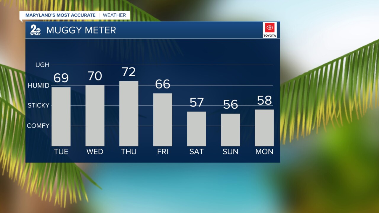
If you've had enough of this intense heat, there is a cold front coming to the rescue on Thursday! Behind the slow-moving cold front, humidity levels drop and temperatures trend cooler than normal on Friday and this weekend!
#StevieDanielsWX #Heat
Email: stevie.daniels@wmar.com
Facebook: www.facebook.com/StevieDanielsWX
X: www.twitter.com/StevieDanielsWX
Instagram & TikTok: stevie_daniels_

