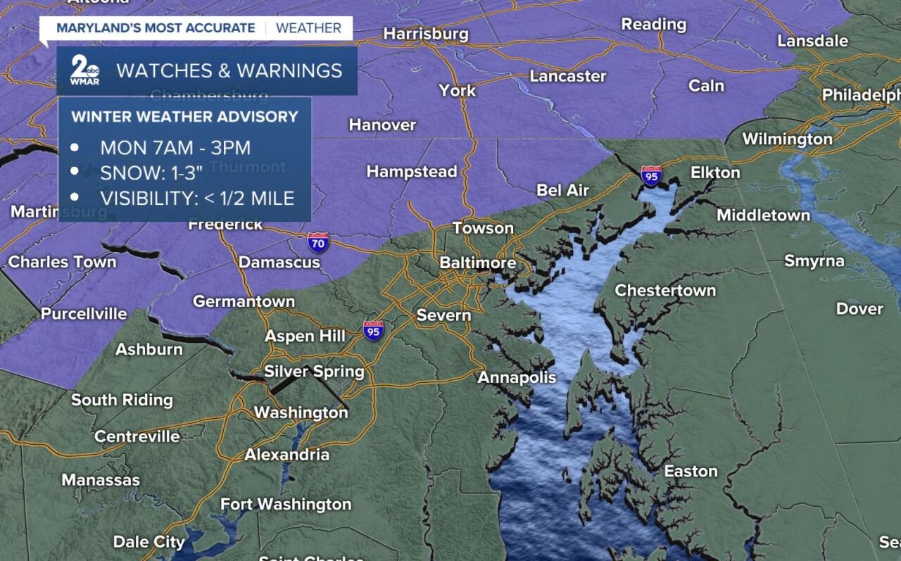
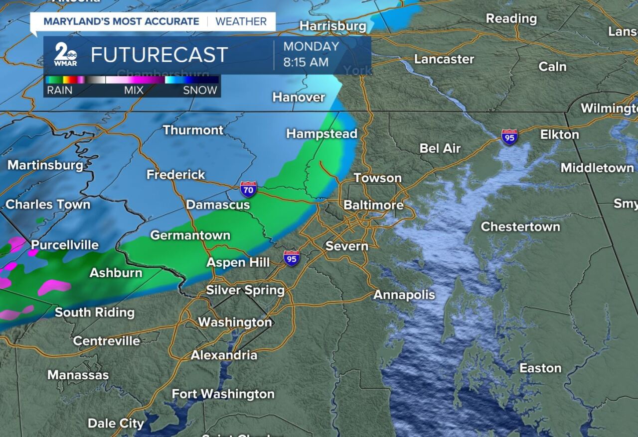
More snow! That's right, the wintry weather only took a break for 2 days! A Winter Weather Advisory is up Monday from 7AM -3PM for Carroll, NW Howard, N Baltimore, and N Harford county. Visibility will fall, possibly turning dense at times in the late morning. Snow moves into our area around 8:30 am.
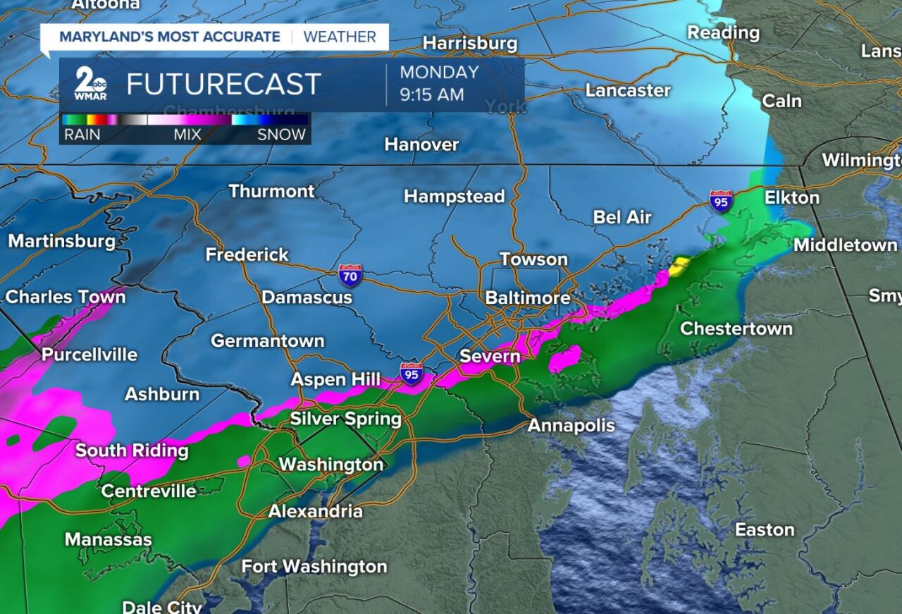
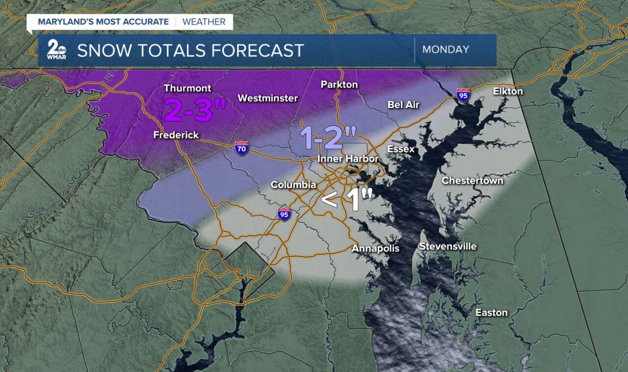
Around noon/1PM warm air moves in thanks to a southerly wind and quickly turns the wintry mess into rain. It will also drive temperatures up to the low 40s. The rain will end when a cold front moves though around 4PM. Snow totals range from 1-3", but downtown Baltimore south toward Annapolis could just see a dusting. East of the bay will pick up .50" of rain instead of snow.
Whatever accumulates will not be around for long. Temps behind the front don't really get cooler. We see the 50s Tuesday!!!
