

BALTIMORE — The new year came in with no major weather issues as we saw a nice and pretty mild night but things are starting to change. Models are showing signs that we could be dealing with our first snowstorm of the season and could even be a strong one. So, come along and take a look at the key components the WMAR 2-News team looks at when forecasting a snowstorm.
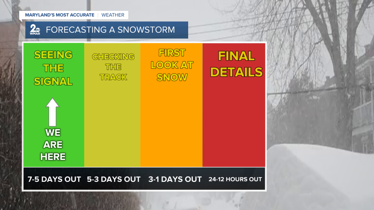
We first start off by looking at relevant weather model data. This is where we begin to "see the signal" of a snowstorm. This means that we are seeing the potential atmospheric setup for the upcoming weather system to be a snowstorm.
In this case we look for the classic setup of cold air that is kept in place by a high pressure system. So, we look at the big three models- the European, American, and Canadian global models- to see if they are all showing a similar setup.
This is what we have going on so far. Then, we begin to look at a rough track of where this next system would make it's way through.


The storm has to track roughly along the east coast for us to get a good snowstorm going and the models are showing that we do have that potential marching line. This track is the key to whether we see snow or rain as a more inland track will bring in warmer air and but a track right along the coast means colder air. One important note, if the track is too far off to the east (more coastal) we could get missed by the storm altogether.
So, those are the first steps of forecasting this potential snowstorm. As we continue to see the models update over the next two days a track will be better mapped out. Once we get about to about two days out we then begin to have other models that will allow for more precise timing and even snowfall range.
This is where we get our rough estimates for snowfall amounts and a better sense of when the snow begins to fall/transitions to snow from rain.
Once we get to about a day out we can truly fine tune snowfall amounts and locate where some of the heaviest bright banding will occur (where snow squalls could form causing heavy snowfall rates).
Be sure to stick with us this week as we welcome in this next big system, rain or snow!

