


We've been stuck in this steamy and stormy weather pattern that feels like it's been going on forever. It has to do with many different factors that are amplifying our typical summertime pattern:
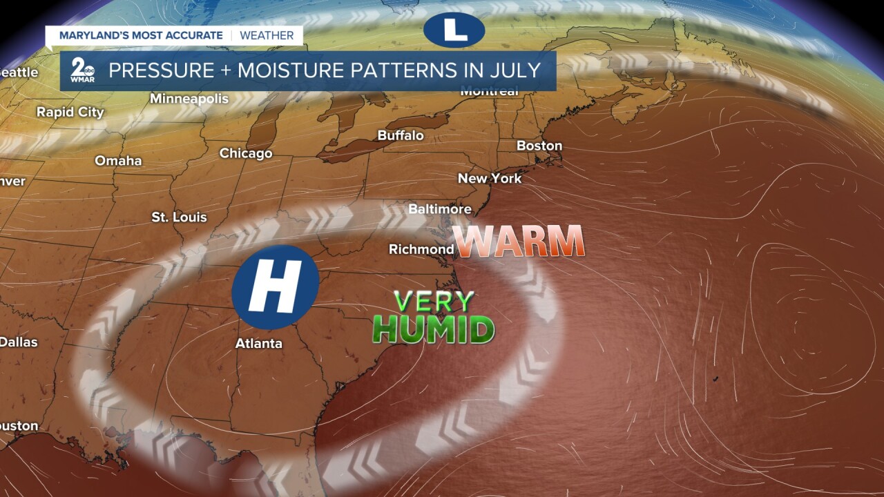
- A persistent high pressure system parked over the eastern US. This traps heat and moisture, while southerly winds draws in the hot, sticky air from the Gulf and the Atlantic.
- Remnants of Tropical Storm Chantal, brought deep tropical moisture into the Mid-Atlantic.
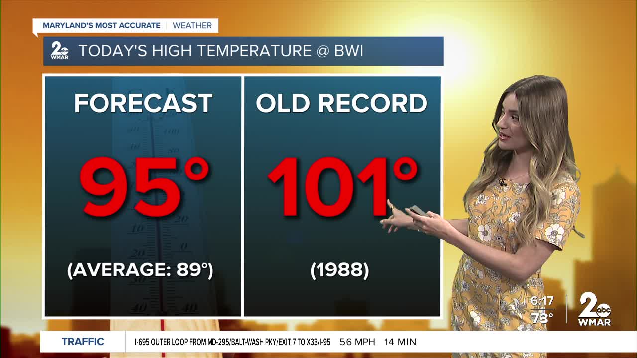
- Dew points have been in the mid-70s— giving us that tropical-like air mass.
- Daily summertime slow-moving storms increases flood risk.
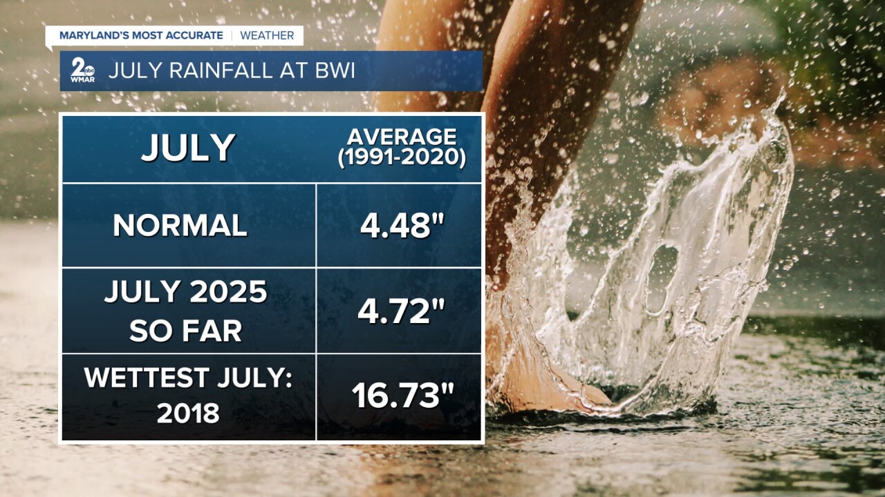
The average monthly rainfall total for the month of July is 4.48", and Baltimore has already measured more than that! The wettest July on record was back in 2018 with 16.73" of rainfall measured at the BWI airport. This beat the old record of 11.03" set back in 1889.
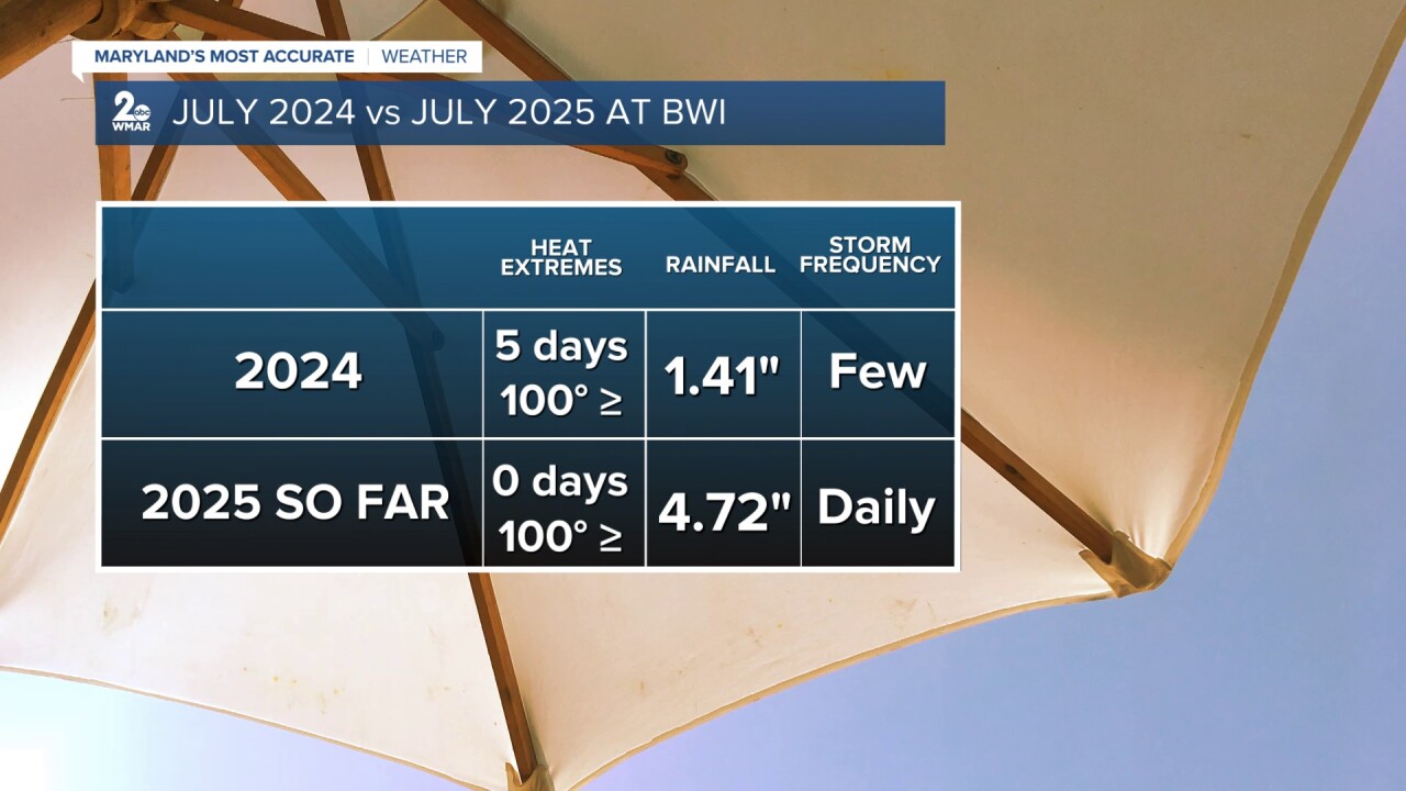
Nearly half of the days this month have featured either thunderstorms or heavy rain across Baltimore. When we compare this month to last year, the difference is clear...
-July 2025: More humid and stormier
-July 2024: Drier, hotter, and more extreme heat
While heat and humidity are normally a part of summertime here in Maryland, this year's setup has taken it to another level!
#StevieDanielsWX #SciencewithStevie
Email: stevie.daniels@wmar.com
Facebook: www.facebook.com/StevieDanielsWX
X: www.twitter.com/StevieDanielsWX
Instagram & TikTok: stevie_daniels_

