


BALTIMORE — Good Tuesday night!
Hallelujah! The warmth felt great today, and at long last the snow is beginning to melt—at least a little. A cold front will swing through tonight, bringing increasing clouds and possibly a quick sprinkle. Behind the front, temperatures will dip slightly on Wednesday, and it will turn noticeably windier. Gusts may occasionally top 35 mph Wednesday afternoon.
Sunshine returns Wednesday through Saturday before our next coastal storm approaches on Sunday. Forecast models are now hinting that this system may track farther offshore. What does that mean for you? A drier trend for Sunday. While there’s still a chance for some rain—and perhaps a brief mix of sleet or wet snow at the onset—recent model trends suggest a much less impressive storm.
Enjoy the warmer temperatures!
Dylan

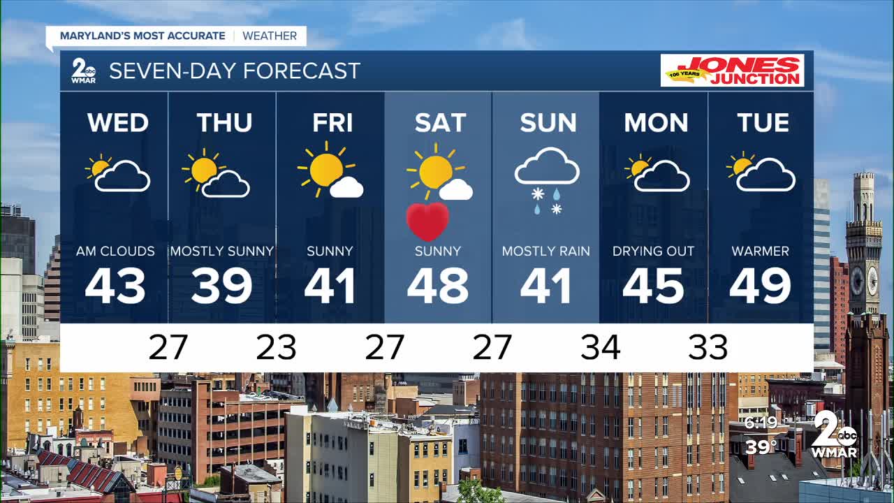
7 Day Forecast:
Wednesday Partly sunny, with a high near 43.
Wednesday Night Partly cloudy, with a low around 27.
Thursday Mostly sunny, with a high near 39.
Thursday Night Mostly cloudy, with a low around 23.
Friday Sunny, with a high near 41.
Friday Night Mostly clear, with a low around 27.
Saturday Sunny, with a high near 46.
Saturday Night Mostly cloudy, with a low around 27.
Sunday Rain and snow. Cloudy, with a high near 41.
Sunday Night Rain. Low around 34.
Washington's Birthday Drying out. Partly sunny, with a high near 44.
Monday Night Partly cloudy, with a low around 32.
Tuesday Mostly sunny, with a high near 47.

