


BALTIMORE — Good Wednesday night!
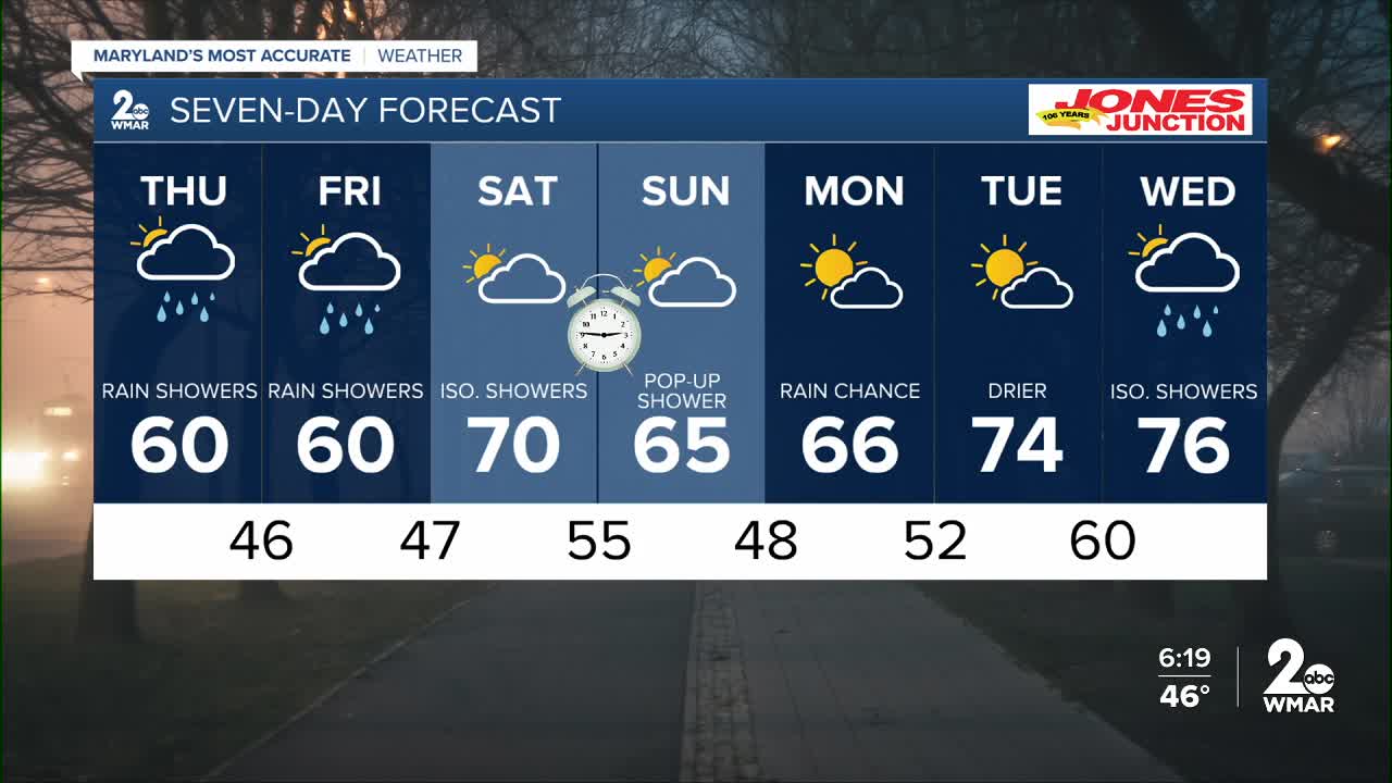
Showers will continue through tonight, along with areas of dense fog. A few rumbles of thunder can’t be ruled out. Thursday will start off foggy, but it will be a bit drier than today and noticeably warmer.
The forecast turns considerably drier for the weekend and beyond, accompanied by a significant warming trend. And don’t forget — we spring forward this weekend! Be sure to set your clocks ahead one hour before bed on Saturday, as Daylight Saving Time begins Sunday morning at 2:00 a.m. That means sunset will be after 7:00 p.m. on Sunday!
Stay dry,
Dylan

7 Day Forecast:
Thursday Scattered showers. Patchy fog. Otherwise, mostly cloudy, with a high near 59.
Thursday Night Showers likely. Mostly cloudy, with a low around 46.
Friday A chance of showers. Mostly cloudy, with a high near 60.
Friday Night Mostly cloudy, with a low around 47.
Saturday A chance of showers. Partly sunny, with a high near 72.
Saturday Night Showers likely. Mostly cloudy, with a low around 55.
Sunday A chance of showers. Partly sunny, with a high near 67.
Sunday Night Mostly cloudy, with a low around 48.
Monday Partly cloudy, with a high near 70.
Monday Night Partly cloudy, with a low around 52.
Tuesday Partly cloudy, with a high near 74.

