


BALTIMORE — Good Tuesday evening!
The Canadian wildfire smoke will stick around through the day tomorrow, reducing air quality to moderate in our region. Air quality will be much worse farther north in NYC, and Boston!


Weather wise - we aren't looking at any major storms anytime soon. In fact, we only have a small chance of a stray shower Wednesday and Thursday, then we dry out for the weekend. Despite the low rain chances, skies will remain cloudy on Wednesday, with the best chance of a stray shower being south of Baltimore.

The weekend will be very sunny, and slightly warmer. We return to a typical hot and humid pattern by early next week.

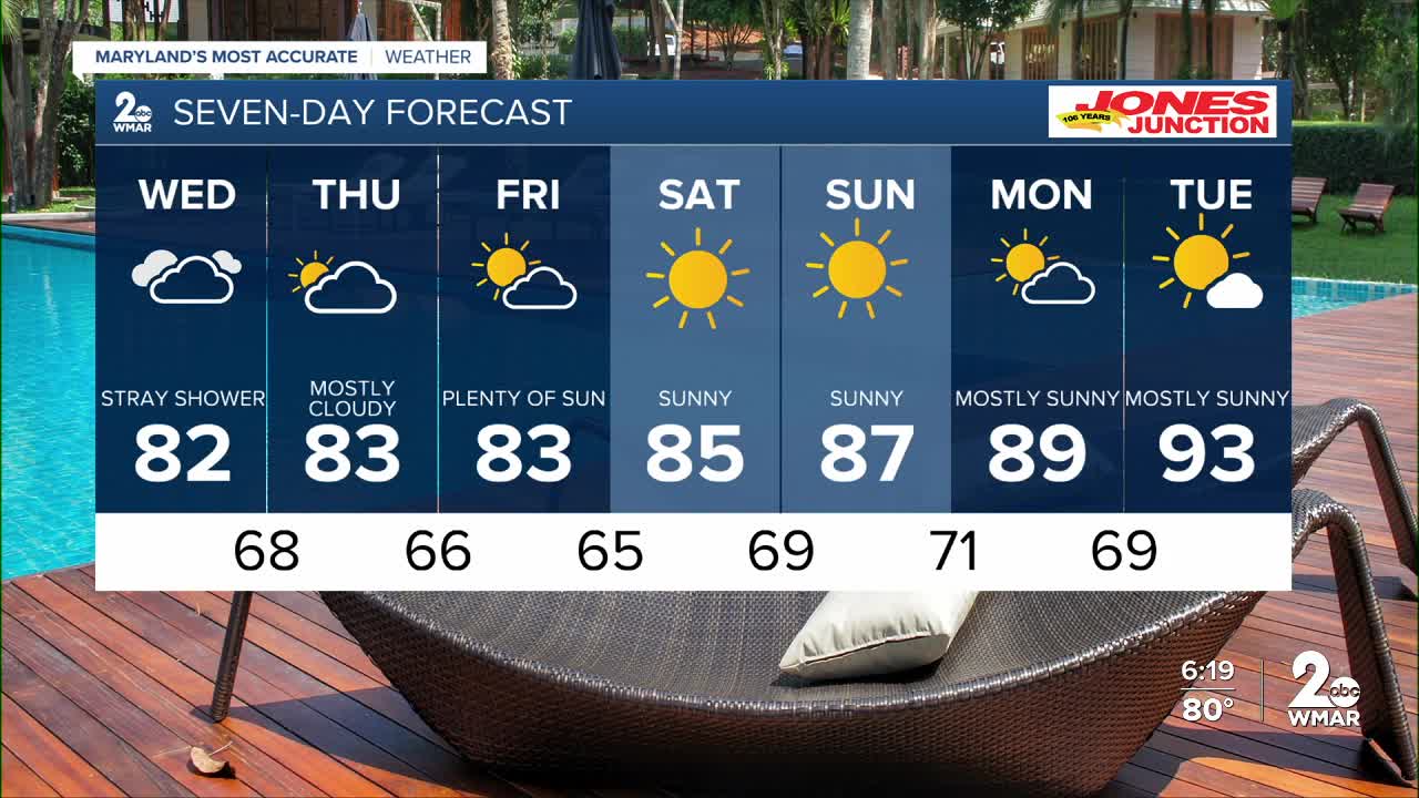
7 Day Forecast:
Wednesday Mostly cloudy, with a high near 81.
Wednesday Night Mostly cloudy, with a low around 68.
Thursday Mostly sunny, with a high near 83.
Thursday Night Mostly clear, with a low around 66.
Friday Mostly sunny, with a high near 83.
Friday Night Partly cloudy, with a low around 65.
Saturday Mostly sunny, with a high near 84.
Saturday Night Mostly cloudy, with a low around 69.
Sunday Partly sunny, with a high near 85.
Sunday Night Mostly cloudy, with a low around 71.
Monday A chance of showers and thunderstorms. Partly sunny, with a high near 89.
Monday Night Partly cloudy, with a low around 72.
Tuesday Mostly sunny, with a high near 94.

