


BALTIMORE — Good Wednesday night!
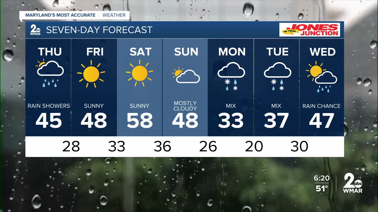
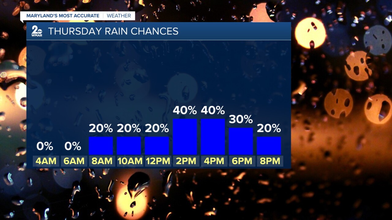
The latest computer guidance now tracks the area of low pressure a bit farther north on Thursday, increasing confidence in a rather wet day. In general, showers look likely between 10 AM and 7 PM. Temperatures will be too warm to support snow for most of the day; however, as we approach sunset around 6 PM, a few areas across northern and northeastern Maryland could see some snow briefly mix in at times.
Sunshine returns for Friday and Saturday before our attention shifts to a potential wintry mix early next week. As of now, there appears to be ample cold air in place to support some form of wintry precipitation. The exact type — whether rain, sleet, snow, or freezing rain — will depend on how much warm air develops aloft. We expect to have a clearer picture of timing and potential impacts later this week. In the meantime, if you plan to travel across the Mid-Atlantic or Northeast early next week, be sure to stay up to date with the latest forecast.
Dylan

7 Day Forecast:
Friday Mostly sunny, with a high near 46.
Friday Night Partly cloudy, with a low around 32.
Saturday Sunny, with a high near 57.
Saturday Night Partly cloudy, with a low around 36.
Sunday Partly sunny, with a high near 47.
Sunday Night A chance of snow. Mostly cloudy, with a low around 28.
Monday A chance of rain and snow. Mostly cloudy, with a high near 37.
Monday Night A chance of rain and snow. Mostly cloudy, with a low around 25.
Tuesday A chance of rain and snow. Mostly cloudy, with a high near 37.
Tuesday Night Rain likely. Cloudy, with a low around 33.
Wednesday A chance of rain. Partly sunny, with a high near 49.

