


BALTIMORE — Good Tuesday night!
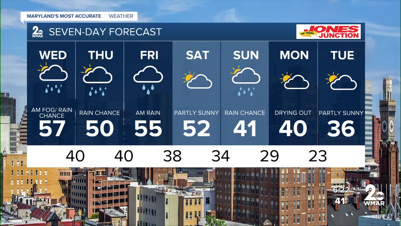
Dense fog is expected to redevelop overnight, with visibility dropping to a quarter mile or less in some areas. A weak system moves through on Wednesday, bringing patchy drizzle and a few light rain showers. We dry out Wednesday night into Thursday morning before a stronger system arrives, bringing rain Thursday evening through Friday morning.
Conditions trend drier on Saturday, then our attention turns to another storm on Sunday. At this point, that system looks mainly wet, though a few computer models are hinting at the possibility of some snow mixing in late. As always, model guidance beyond three days should be taken with a grain of salt — but we’ll be keeping a close eye on the trend.
Thanks,
Dylan

7 Day Forecast:
Wednesday A chance of rain. Mostly cloudy, with a high near 58.
Wednesday Night A slight chance of rain. Partly cloudy, with a low around 42.
Thursday A chance of rain. Mostly cloudy, with a high near 52.
Thursday Night Rain likely. Cloudy, with a low around 38.
Friday Rain. High near 50.
Friday Night A chance of rain. Mostly cloudy, with a low around 38.
Saturday A chance of rain. Partly sunny, with a high near 49.
Saturday Night A chance of rain. Mostly cloudy, with a low around 33.
Sunday A chance of rain and snow. Partly sunny, with a high near 43.
Sunday Night A chance of snow. Mostly cloudy, with a low around 28.
Monday Partly sunny, with a high near 39.

