


BALTIMORE — Good Wednesday night!
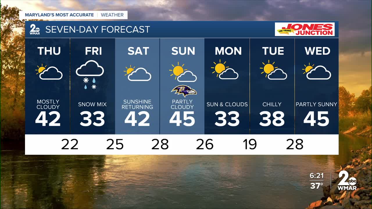
We enjoyed a brief return of sunshine today, but don’t get too comfortable — clouds will be on the increase Thursday as a cold front moves through. And if you think it’s chilly now, the next few mornings may not be your favorite. Overnight lows are expected to fall into the low 20s from Thursday night into Friday morning.
There’s also been plenty of chatter about the potential for snow on Friday. While snow is certainly possible, nothing is locked in yet. Forecast models are still split on how far north the storm system will track. We’ll have plenty of cold air in place, but the big question is whether we’ll have enough moisture. A more northerly track could bring 1–2 inches of snow, while a more southerly path could leave us with nothing at all.
We’ll keep you updated as the picture becomes clearer — but it wouldn’t hurt to keep the snow brush within reach, just in case!


7 Day Forecast:
Thursday Increasing clouds, with a high near 43.
Thursday Night Partly cloudy, with a low around 20.
Friday A chance of a light wintry mix and snow. Mostly cloudy, with a high near 35.
Friday Night A chance of light snow. Mostly cloudy, with a low around 25.
Saturday Partly sunny, with a high near 44.
Saturday Night Mostly cloudy, with a low around 28.
Sunday Partly cloudy, with a high near 43.
Sunday Night Mostly cloudy, with a low around 27.
Monday Partly cloudy, with a high near 37.
Monday Night Partly cloudy, with a low around 22.
Tuesday Partly cloudy, with a high near 39.
Tuesday Night Mostly cloudy, with a low around 28.
Wednesday Partly sunny, with a high near 44.

