


BALTIMORE — Ready or not...here comes another heat wave!
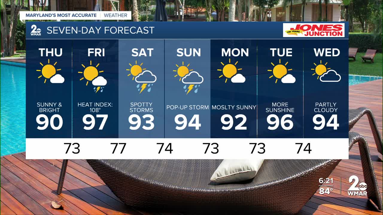
The hottest day of the week will be Friday, with a heat index of 108°.
If you can stay inside Friday, it's recommended as heat related illness can set in very quick, especially with these high humidity levels!

We have added a chance of rain to the forecast on Friday as a cold front slides down to the south. Rain chances will be highest Saturday and Sunday with a 30% coverage of showers in our region!


7 Day Forecast:
Thursday Mostly sunny, with a high near 91.
Thursday Night Mostly clear, with a low around 73.
Friday Chance of showers. Mostly sunny and hot, with a high near 97.
Friday Night Mostly cloudy, with a low around 77.
Saturday A chance of showers and thunderstorms. Partly cloudy, with a high near 93.
Saturday Night A chance of showers and thunderstorms. Mostly cloudy, with a low around 74.
Sunday A chance of showers, then possibly a thunderstorm. Partly cloudy, with a high near 90.
Sunday Night Showers and thunderstorms likely. Partly cloudy, with a low around 73.
Monday Mostly sunny, with a high near 90.
Monday Night Mostly clear, with a low around 73.
Tuesday Mostly sunny, with a high near 92.
Tuesday Night Partly cloudy, with a low around 74.
Wednesday Partly cloudy, with a high near 95.

