


BALTIMORE — Good Monday night!
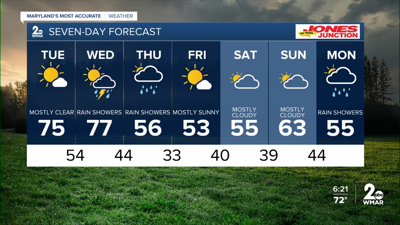
Tuesday’s weather will feel a lot like Monday, with plenty of sunshine and very warm temperatures sticking around. A few showers and storms will develop across western Maryland during the day, and one or two wandering showers could drift toward the Chesapeake, but most of us should stay dry.
Our next, more potent storm system arrives Wednesday evening and could bring a round of thunderstorms. There will be enough instability and moisture in the atmosphere for one or two storms to become severe, with the main threats being heavy rain and gusty winds.
A few showers may linger into Thursday, but by then the instability will be gone, so we’re mainly looking at plain rain rather than severe storms.
Enjoy the spring-like temperatures!
Dylan

7 Day Forecast:
Tuesday Sunny, with a high near 75.
Tuesday Night Mostly clear, with a low around 54.
Wednesday A chance of rain. Mostly cloudy, with a high near 76.
Wednesday Night Rain likely. Mostly cloudy, with a low around 44.
Thursday Rain likely. Mostly cloudy, with a high near 57.
Thursday Night A chance of rain. Mostly clear, with a low around 33.
Friday Partly sunny, with a high near 54.
Friday Night Partly cloudy, with a low around 40.
Saturday Partly sunny, with a high near 55.
Saturday Night Mostly cloudy, with a low around 39.
Sunday Mostly cloudy, with a high near 61.
Sunday Night Rain likely. Mostly cloudy, with a low around 44.
Monday Rain likely. Mostly cloudy, with a high near 54.

