


BALTIMORE — The heavy rain will start to move out of the region tonight, and behind it will be lots of cloud cover that will remain through the day Thursday.
The clouds will be your friend, because it'll keep the temperatures slightly cooler on Thursday, with highs only in the upper 80s.
Moving forward, we'll maintain a slight chance of a pop-up shower/storm each afternoon, but the coverage and intensity of the storms will be less than what we saw earlier this week.
If you plan to go to WTMD'S First Thursday Festival on Canton's waterfront, plan on there being a chance of rain and storms for the start of the concert festival, with improving weather after 7pm.


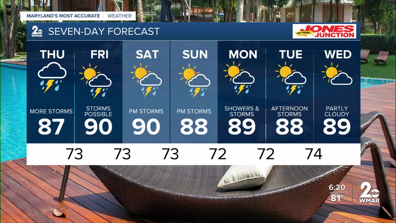
7 Day Forecast:
Thursday Showers and thunderstorms likely. Mostly cloudy, with a high near 87.
Thursday Night Showers likely and possibly a thunderstorm. Mostly cloudy, with a low around 73.
Friday A chance of showers, with thunderstorms. Partly cloudy, with a high near 90.
Friday Night A chance of showers and thunderstorms. Mostly cloudy, with a low around 73.
Saturday A chance of showers and thunderstorms. Partly cloudy, with a high near 90.
Saturday Night A chance of showers and thunderstorms. Partly cloudy, with a low around 73.
Sunday A chance of showers and thunderstorms. Partly cloudy, with a high near 88.
Sunday Night A chance of showers and thunderstorms. Mostly cloudy, with a low around 72.
Monday A chance of showers and thunderstorms. Partly cloudy, with a high near 89.
Monday Night A chance of thunderstorms. Partly cloudy, with a low around 72.
Tuesday A chance of showers. Partly cloudy, with a high near 92.
Tuesday Night A chance of showers and thunderstorms. Partly cloudy, with a low around 74.
Wednesday A chance of showers and thunderstorms. Mostly sunny, with a high near 93.

