


BALTIMORE — Good Monday night!
Please use caution if you’re out driving this evening—especially on bridges and overpasses—as temperatures are expected to fall well below freezing, which could lead to icy spots. Sunshine returns tomorrow, but winds will remain gusty, particularly along the Eastern Shore.
A weak front moves through Tuesday night, bringing a few rain and snow showers. Then, a much larger storm system arrives Thursday. Right now, it appears more likely to bring rain than snow. However, timing will be key: a morning arrival could result in more of a wintry mix, while an afternoon arrival would favor mostly rain.
Either way, it’s a system worth watching as we get closer.
Dylan

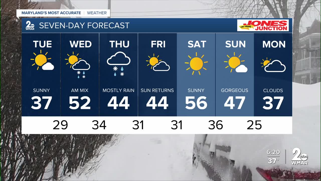
7 Day Forecast:
Tuesday Partly cloudy, with a high near 37.
Tuesday Night A chance of snow mixing with rain. Mostly cloudy, with a low around 28.
Wednesday Partly sunny, with a high near 51.
Wednesday Night Partly cloudy, with a low around 32.
Thursday Rain likely. Mostly cloudy, with a high near 50.
Thursday Night Rain likely. Mostly cloudy, with a low around 34.
Friday Partly cloudy, with a high near 48.
Friday Night Mostly clear, with a low around 32.
Saturday Sunny, with a high near 53.
Saturday Night Partly cloudy, with a low around 35.
Sunday Mostly sunny, with a high near 51.

