

BALTIMORE — Good Wednesday night!
A cold front slides through tonight, bringing showers and storms to the region. The clouds and earlier showers today zapped much of the instability out of the atmosphere, meaning our severe weather risk is lower. Expect showers from now through 9 PM, with a few occasional claps of thunder.
Skies clear after midnight, with sunshine returning tomorrow! A weak disturbance moves in Friday evening, bringing a few light showers, but we dry out nicely for the weekend.
Dylan

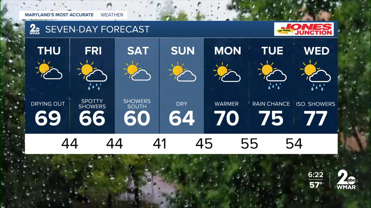
7 Day Forecast:
Thursday Mostly sunny, with a high near 66.
Thursday Night Mostly clear, with a low around 44.
Friday A chance of showers. Mostly sunny, with a high near 64.
Friday Night A chance of showers. Mostly cloudy, with a low around 44.
Saturday Partly sunny, with a high near 60.
Saturday Night Partly cloudy, with a low around 41.
Sunday Mostly sunny, with a high near 64.
Sunday Night Partly cloudy, with a low around 45.
Monday Mostly sunny, with a high near 69.
Monday Night Partly cloudy, with a low around 48.
Tuesday A chance of showers. Mostly sunny, with a high near 72.
Tuesday Night A chance of showers. Partly cloudy, with a low around 41.
Wednesday A chance of showers. Mostly sunny, with a high near 74.

