


BALTIMORE — Good Monday evening!
If you’re heading out tonight, use extra caution—areas of dense fog are expected to develop, with visibility dropping to a quarter mile or less by early Tuesday morning. The fog should clear shortly after sunrise, but clouds will stick around through the rest of the day.
Temperatures turn mild Tuesday and Wednesday, with afternoon highs climbing well into the 50s.
A weak disturbance moves through Wednesday, bringing the chance for a few light showers. Then a stronger system arrives Thursday night into Friday, producing another round of steady rain similar to what we saw Sunday night.
The weekend remains unsettled, with rain chances continuing both Saturday and Sunday. With the combination of mild temperatures and rainfall, the remaining snowpack will likely melt away by the end of the week.
Dylan

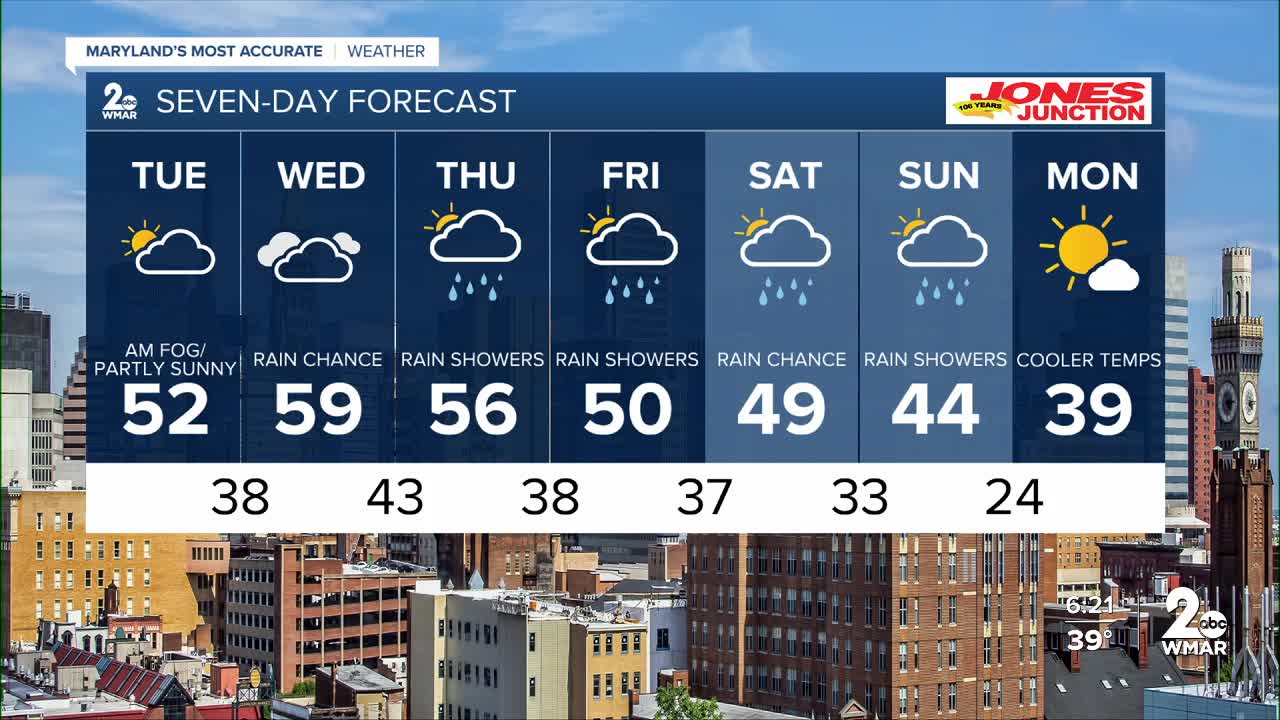
7 Day Forecast:
Tuesday Patchy fog. Otherwise, partly sunny, with a high near 52. Light southwest wind.
Tuesday Night Cloudy, with a low around 38. Calm wind.
Wednesday A chance of rain. Mostly cloudy, with a high near 59.
Wednesday Night Partly cloudy, with a low around 43.
Thursday A chance of rain. Partly sunny, with a high near 56.
Thursday Night Rain likely. Mostly cloudy, with a low around 38.
Friday Rain likely. Mostly cloudy, with a high near 50.
Friday Night A chance of rain. Mostly cloudy, with a low around 37.
Saturday A chance of rain. Mostly cloudy, with a high near 49.
Saturday Night A chance of rain. Mostly cloudy, with a low around 33.
Sunday A chance of rain. Partly sunny, with a high near 44.
Sunday Night A chance of rain. Mostly cloudy, with a low around 27.
Monday Mostly sunny, with a high near 39.

