


BALTIMORE — Good Thursday night!
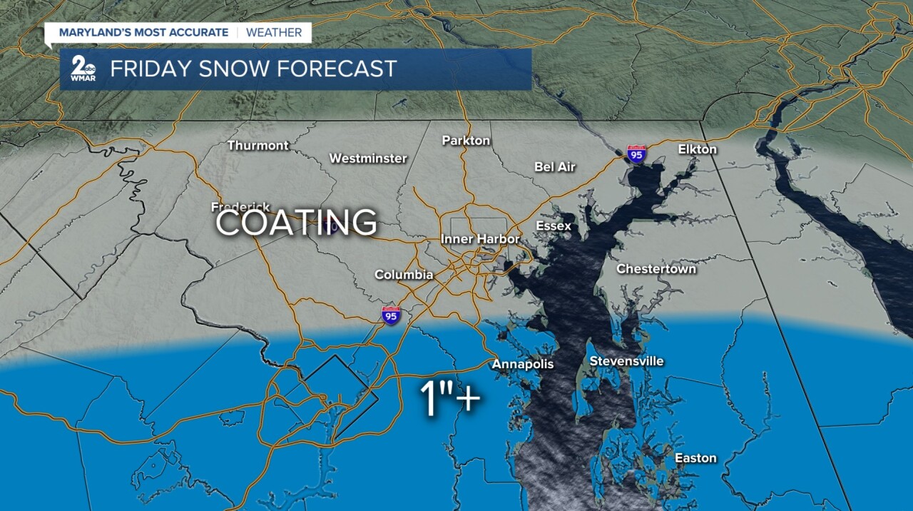
A Winter Weather Advisory has been issued for central and southern Maryland from 4 AM to 4 PM Friday. Confidence is high that these areas will see their first accumulating snowfall of the season. However, there is still uncertainty regarding how far north the snowfall will extend.
Model guidance continues to disagree on the northern edge of the accumulating snow. At the moment, most models place Annapolis near the cutoff line. What does that mean? It suggests that locations north of Annapolis may miss out on this round of snow altogether.
If you live in Anne Arundel, Montgomery, or Prince George’s County, the odds are in your favor for seeing accumulating snowfall!
Either way you swing it - this is a good reminder to get the snow brush ready and be prepared for whatever Mother Nature throws our way!


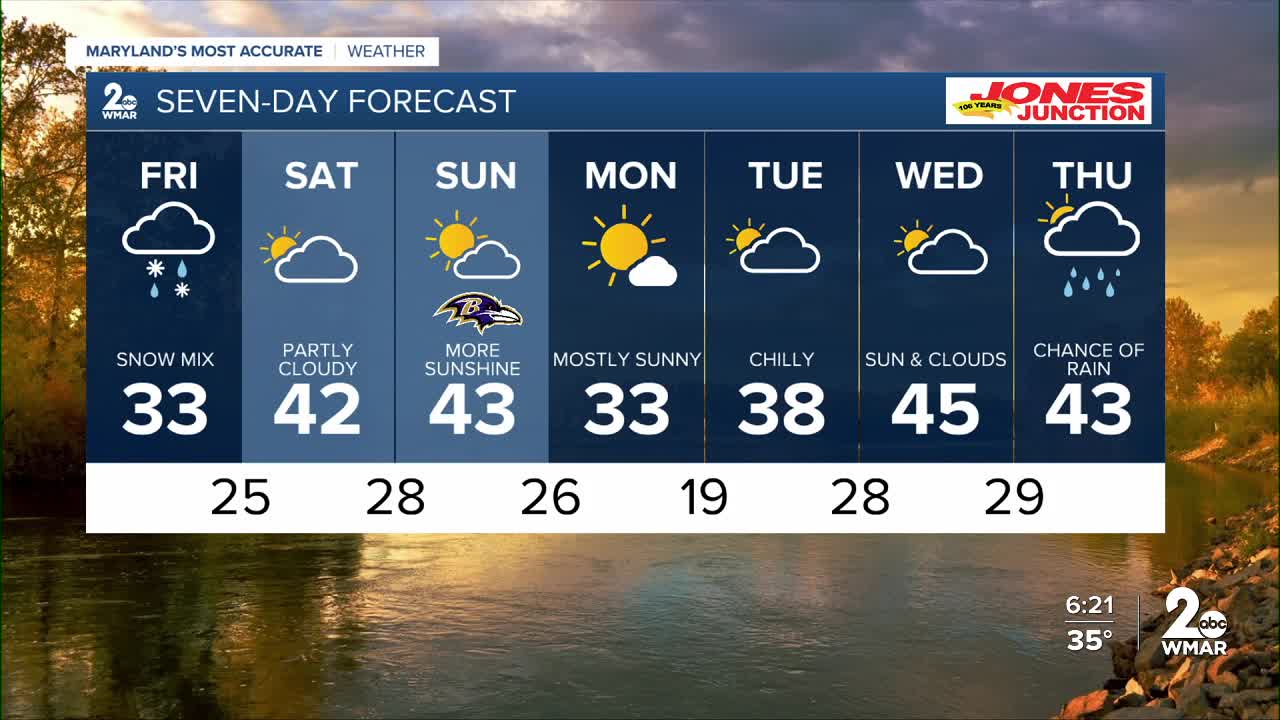
7 Day Forecast:
Friday Snow and a wintry mix likely. Mostly cloudy, with a high near 33.
Friday Night A slight chance of snow. Mostly cloudy, with a low around 25.
Saturday Partly sunny, with a high near 42.
Saturday Night Partly cloudy, with a low around 28.
Sunday Partly cloudy, with a high near 45.
Sunday Night Mostly cloudy, with a low around 26.
Monday Mostly sunny, with a high near 33.
Monday Night Partly cloudy, with a low around 19.
Tuesday Partly cloudy, with a high near 39.
Tuesday Night Mostly cloudy, with a low around 28.
Wednesday Partly sunny, with a high near 45.
Wednesday Night A chance of rain. Mostly cloudy, with a low around 29.
Thursday A chance of rain. Partly sunny, with a high near 43.

