


BALTIMORE — Good Monday night!
If you’ve been craving a taste of warmer air, you’re going to like this week’s forecast. We finally climb above the 40° mark — something we haven’t done since January 23rd. That’s 17 straight days stuck below 40°, so yes… it’s been a cold stretch.
Tuesday will feature a noticeable increase in cloud cover as a fast-moving front passes through the region. Most of the moisture stays well to our north, but a few spots could see some patchy drizzle Tuesday night.
The rest of the week looks fairly quiet — at least until we get to the weekend. Forecast models are starting to hint at a possible coastal storm on Sunday. Right now, the trend favors more wet than white, but the storm’s exact track will be key. Any shift could change the outcome between rain, mixed precipitation, or even snow.
Plenty to watch over the next few days — stay tuned!
— Dylan

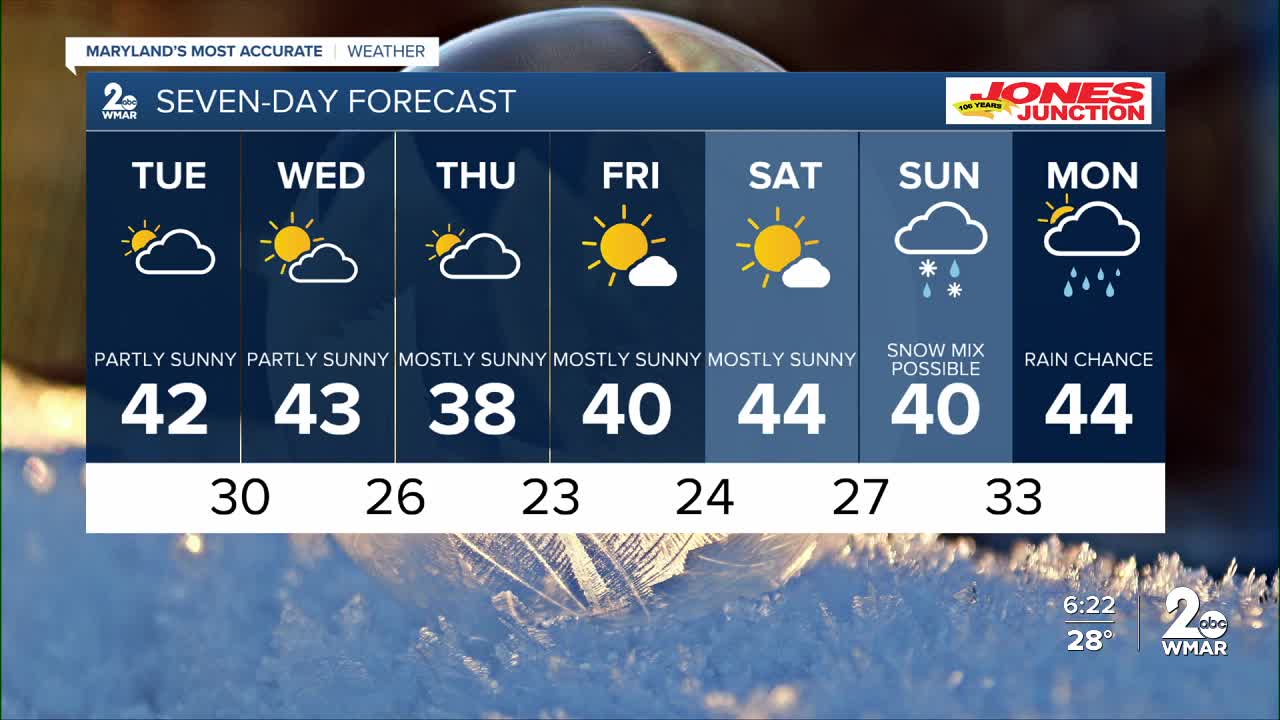
7 Day Forecast:
Tuesday Partly cloudy, with a high near 42.
Tuesday Night Partly cloudy, with a low around 30.
Wednesday Partly sunny, with a high near 43.
Wednesday Night Partly cloudy, with a low around 26.
Thursday Partly sunny, with a high near 38.
Thursday Night Mostly cloudy, with a low around 23.
Friday Partly cloudy, with a high near 39.
Friday Night Mostly clear, with a low around 24.
Saturday Partly cloudy, with a high near 41.
Saturday Night A chance of snow. Mostly cloudy, with a low around 27.
Sunday A chance of rain and snow. Cloudy, with a high near 39.
Sunday Night Rain. Low around 33.
Washington's Birthday A chance of rain. Partly sunny, with a high near 43.

