


BALTIMORE — Good Tuesday night!
We’re still on track to see a few snow showers tonight, with the only forecast update being that the system is now expected to track a bit farther south.
The best chance for snow showers will be between 9 PM tonight and 3 AM Wednesday. Little to no accumulation is expected.
Behind this system, another surge of cold air moves in, sending temperatures back below freezing for Wednesday.
We’re also watching another chance for snow on Friday. Similar to tonight, any accumulation looks minimal at this time.
Looking ahead: The weekend will be sunny and dry, but very cold and windy.
Stay warm,
Dylan

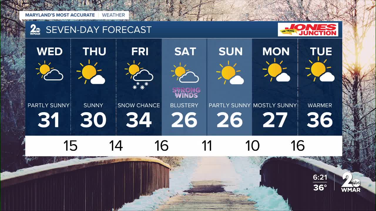
7 Day Forecast:
Wednesday Mostly sunny, with a high near 31.
Wednesday Night Partly cloudy, with a low around 15.
Thursday Sunny, with a high near 30.
Thursday Night Partly cloudy, with a low around 14.
Friday A chance of snow. Partly sunny, with a high near 34.
Friday Night Partly cloudy, with a low around 16.
Saturday Sunny, with a high near 26.
Saturday Night Mostly clear, with a low around 11.
Sunday Mostly sunny, with a high near 26.
Sunday Night Partly cloudy, with a low around 10.
Monday Mostly sunny, with a high near 27.
Monday Night Partly cloudy, with a low around 16.
Tuesday Mostly sunny, with a high near 36.

