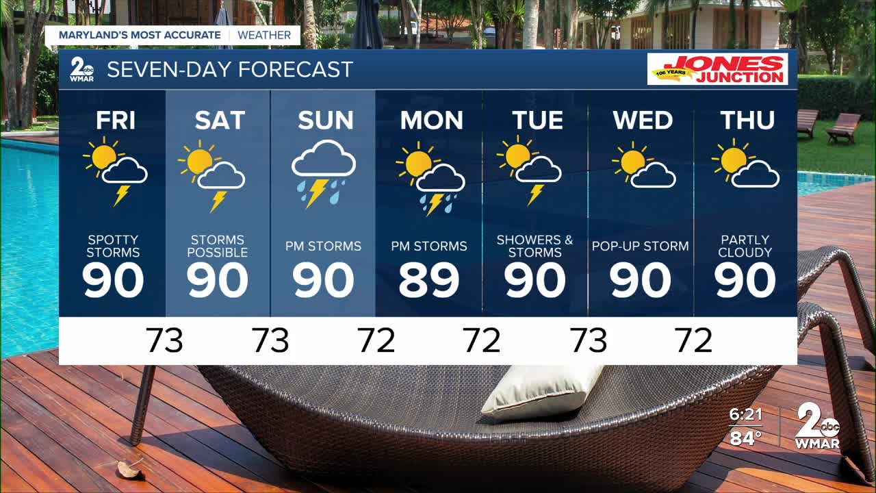


BALTIMORE — Rain coverage is pretty low Friday and Saturday - with coverage only around 30% of the viewing area. With that being said, new model data suggests Sunday night into Monday could be wetter as a descending cold front arrives to the area. The severe weather threat is very low this weekend, and any storms that form should remain non-severe.

7 Day Forecast:
Friday A chance of showers and thunderstorms. Patchy fog. Otherwise, partly sunny, with a high near 90.
Friday Night A chance of showers and thunderstorms. Partly cloudy, with a low around 73.
Saturday A chance of showers and thunderstorms. Partly sunny, with a high near 90.
Saturday Night A chance of thunderstorms. Mostly cloudy, with a low around 73.
Sunday A chance of showers and thunderstorms. Partly sunny, with a high near 89.
Sunday Night A chance of showers and thunderstorms. Mostly cloudy, with a low around 72.
Monday A chance of showers, then showers and thunderstorms. Partly sunny, with a high near 88.
Monday Night Showers and thunderstorms likely. Mostly cloudy, with a low around 72.
Tuesday A chance of showers and thunderstorms. Partly sunny, with a high near 87.
Tuesday Night A chance of showers and thunderstorms. Partly cloudy, with a low around 73.
Wednesday A chance of showers and thunderstorms. Mostly sunny, with a high near 90.
Tuesday Night A chance of showers and thunderstorms. Partly cloudy, with a low around 72.
Wednesday A chance of showers and thunderstorms. Mostly sunny, with a high near 92.

