


BALTIMORE — Good Thursday night!
We will maintain the chance of a shower or storm through midnight. Any storms that form will pose a damaging wind threat, however, the flood risk is much lower today compared to previous days.
Heading into Friday, a cold front will slide through before sunrise, which will bring clouds and cooler temps! Here's the best part...the humidity will finally be lower tomorrow!
Looking ahead to the weekend, rain chances are likely both days, with Saturday being the most likely day for showers and storms.
The weather will be much quieter for Mon-Thu of next week, with lots of sunshine and highs in the 80s!

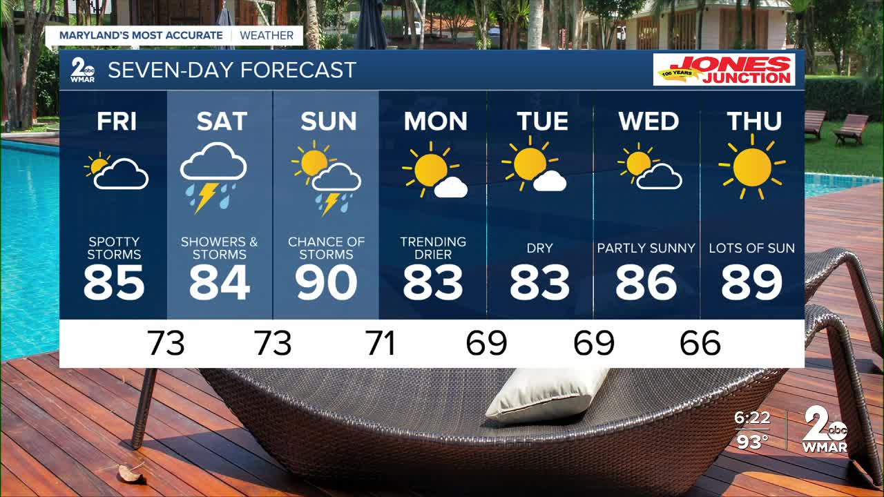
7 Day Forecast:
Friday A slight chance of showers. Mostly sunny, with a high near 89.
Friday Night A slight chance of showers and thunderstorms. Partly cloudy, with a low around 73.
Saturday A chance of showers and possibly a thunderstorm. Mostly cloudy, with a high near 86.
Saturday Night Showers likely and thunderstorms. Mostly cloudy, with a low around 73.
Sunday A chance of showers and thunderstorms. Partly cloudy, with a high near 90.
Sunday Night A chance of showers and thunderstorms. Mostly cloudy, with a low around 71.
Monday Mostly sunny, with a high near 85.
Monday Night Partly cloudy, with a low around 69.
Tuesday Mostly sunny, with a high near 85.
Tuesday Night Partly cloudy, with a low around 69.
Wednesday Partly cloudy, with a high near 89.
Wednesday Night Partly cloudy, with a low around 66.
Thursday Mostly sunny, with a high near 87.

