


BALTIMORE — Good Thursday night!
We’re keeping a close eye on a strong cold front that’s moving in tonight. It’s going to bring heavy rain and some pretty gusty winds late tonight and into Friday.
A Wind Advisory is in effect through 7 PM Friday, with wind gusts potentially topping 55 mph. That means we could see downed trees and even a few isolated power outages, so be sure to secure anything loose outside.
There’s also a chance that a few storms could turn severe between midnight and sunrise, so it’s a good idea to have a way to receive weather alerts overnight.
Most of the rain should move out by sunrise Friday, but don’t be surprised if we see a few showers redevelop late Friday morning or early afternoon as the cold front finishes pushing through.
One last thing to keep in mind—temperatures will be falling throughout the day Friday. We’ll actually start off fairly mild, with morning temperatures in the upper 50s, but by the time kids are getting off the bus in the afternoon, we’ll be down in the 30s as colder air rushes in. Make sure they head to school with a heavy jacket for the ride home.
Stay safe and we’ll keep you updated!


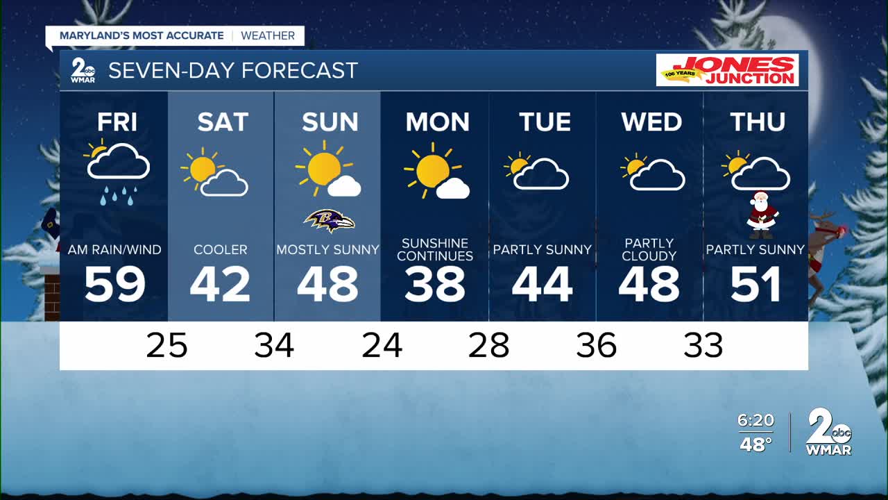
7 Day Forecast:
Tonight Rain. Low around 44. South wind 5-15 mph, with gusts as high as 34 mph.
Friday Rain likely. Cloudy through mid morning, then gradual clearing, with a high near 56. Breezy.
Friday Night Mostly clear, with a low around 26.
Saturday Mostly sunny, with a high near 44.
Saturday Night Partly cloudy, with a low around 36.
Sunday Mostly sunny, with a high near 49.
Sunday Night Mostly clear, with a low around 25.
Monday Mostly sunny, with a high near 38.
Monday Night Mostly cloudy, with a low around 28.
Tuesday A chance of rain and snow. Mostly cloudy, with a high near 44.
Tuesday Night Mostly cloudy, with a low around 36.
Wednesday Partly cloudy, with a high near 49.
Wednesday Night Mostly cloudy, with a low around 39.
Christmas Day Mostly cloudy, with a high near 57.

