


BALTIMORE — Good Thursday night!
Heavy rain will move through the region Thursday night with some areas picking up more than a half inch! Showers wrap up Friday morning, which will leave Friday evening and most of Saturday dry.
Another storm slides in on Sunday, bringing another round of daytime showers. As nighttime arrives, temperatures will drop to around freezing, and we'll see snow mixing in. This storm won't produce a lot of snow based on the fact ground temperatures are relatively mild, and the fact that the the temperature profile in the lowest 5,000' ft of the atmosphere is also warm, which means snow to liquid ratios would be significantly lower than normal. Another contributing factor is that sun angles are higher in late February, which also makes it harder to cool the lower atmosphere.
We'll keep you posted in the event anything changes!
Dylan

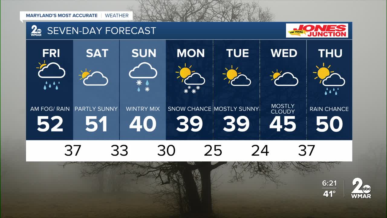
7 Day Forecast:
Friday Rain in the morning. High near 52.
Friday Night Partly cloudy, with a low around 37.
Saturday Partly sunny, with a high near 51.
Saturday Night A chance of rain. Partly cloudy, with a low around 34.
Sunday Rain and snow. High near 41.
Sunday Night Snow likely. Mostly cloudy, with a low around 30.
Monday A chance of snow. Mostly cloudy, with a high near 39.
Monday Night Partly cloudy, with a low around 26.
Tuesday Sunny, with a high near 39.
Tuesday Night Partly cloudy, with a low around 26.
Wednesday Partly sunny, with a high near 45.
Wednesday Night A chance of rain. Mostly cloudy, with a low around 28.
Thursday A chance of rain. Partly sunny, with a high near 50.

