


BALTIMORE — Happy Friday!
Light snow is possible through midnight. Little to no snowfall accumulation is expected. Dangerously cold air slides in this weekend, keeping temperatures well below freezing with wind chills at or below 0° on Saturday. Extreme Cold Warnings go into effect from 4 AM Saturday through 10 AM Sunday. High Wind Warnings go into effect for the area from 4 AM - 7 PM Saturday, where gusts could top 50 mph at times and 60 mph across the higher elevations. This may result in downed trees and isolated power outages. Temperatures rebound into the 40s by the middle of next week!
Stay warm!
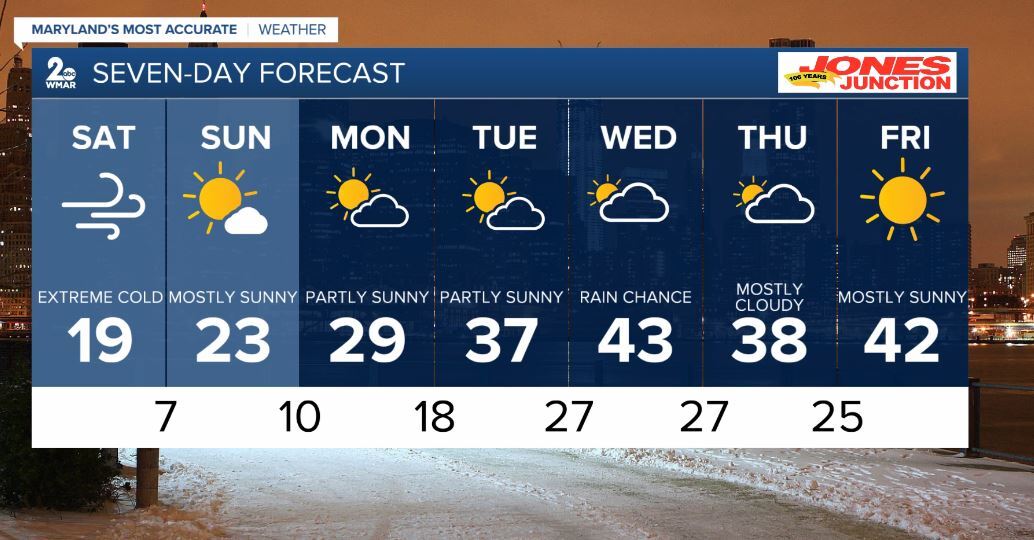
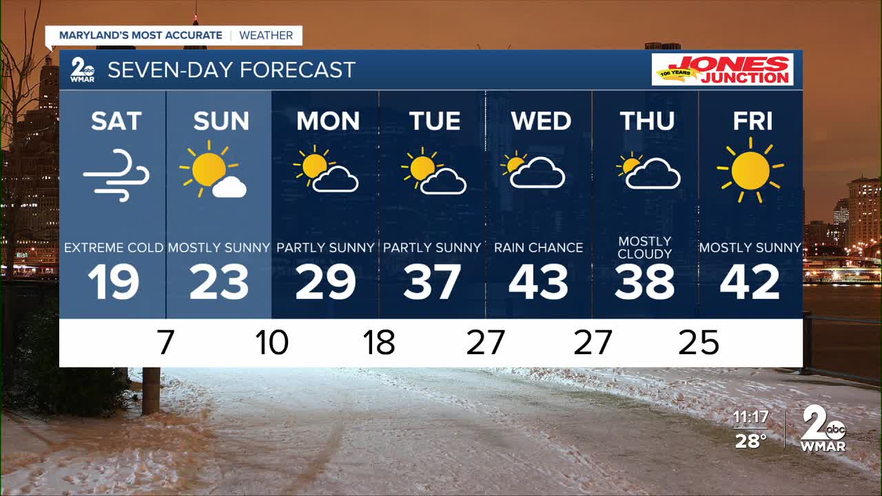
7 Day Forecast:
Today Scattered snow showers. Mostly cloudy, with a high near 33. Light and variable wind.
Tonight Scattered snow showers, mainly before midnight. Cloudy, then gradually becoming partly cloudy, with a low around 11. Light and variable wind becoming northwest 10-20 mph after midnight. Winds could gust as high as 35 mph.
Saturday Sunny, with a high near 19. Windy.
Saturday Night Mostly clear, with a low around 7. Blustery.
Sunday Mostly sunny, with a high near 23.
Sunday Night Partly cloudy, with a low around 10.
Monday Partly sunny, with a high near 29.
Monday Night Mostly cloudy, with a low around 18.
Tuesday Mostly sunny, with a high near 37.
Tuesday Night A chance of freezing rain. Mostly cloudy, with a low around 27.
Wednesday A chance of rain. Mostly cloudy, with a high near 43.
Wednesday Night A chance of rain. Mostly cloudy, with a low around 27.
Thursday Mostly cloudy, with a high near 38.
Thursday Night Mostly cloudy, with a low around 25.
Friday Mostly sunny, with a high near 42.

