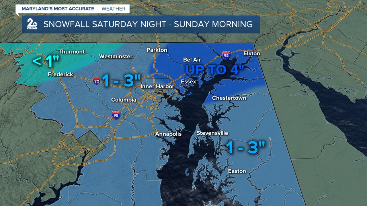


BALTIMORE — Light accumulating snow to the area starting tonight and will linger into Sunday morning. As of right now, anywhere a general 1-3" of snow is expected for the majority of the area, especially along I-95. Isolated spots across northeast MD could see up to 4". If you're traveling either Saturday night or Sunday morning, drive carefully as some untreated roads could be slippery. Turning bitterly cold on Monday morning, thanks to blustery winds. Trending milder through the middle of next week!
Stay weather aware!
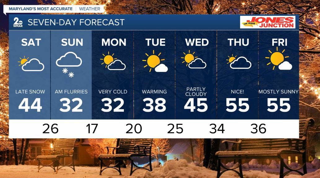
7 Day Forecast:
Today Increasing clouds, with a high near 44. West wind 5 to 7 mph.
Tonight Rain and snow, becoming all snow. The snow could be heavy at times. Low around 26. Calm wind becoming northwest 5 to 7 mph after midnight.
Sunday A chance of snow. Partly sunny, with a high near 32.
Sunday Night Mostly clear, with a low around 17.
Monday Mostly sunny, with a high near 32.
Monday Night Partly cloudy, with a low around 20.
Tuesday Mostly sunny, with a high near 38.
Tuesday Night Partly cloudy, with a low around 25.
Wednesday Mostly sunny, with a high near 45.
Wednesday Night Mostly cloudy, with a low around 34.
Thursday Partly sunny, with a high near 55.
Thursday Night A chance of rain. Mostly cloudy, with a low around 36.
Friday Mostly sunny, with a high near 55.

