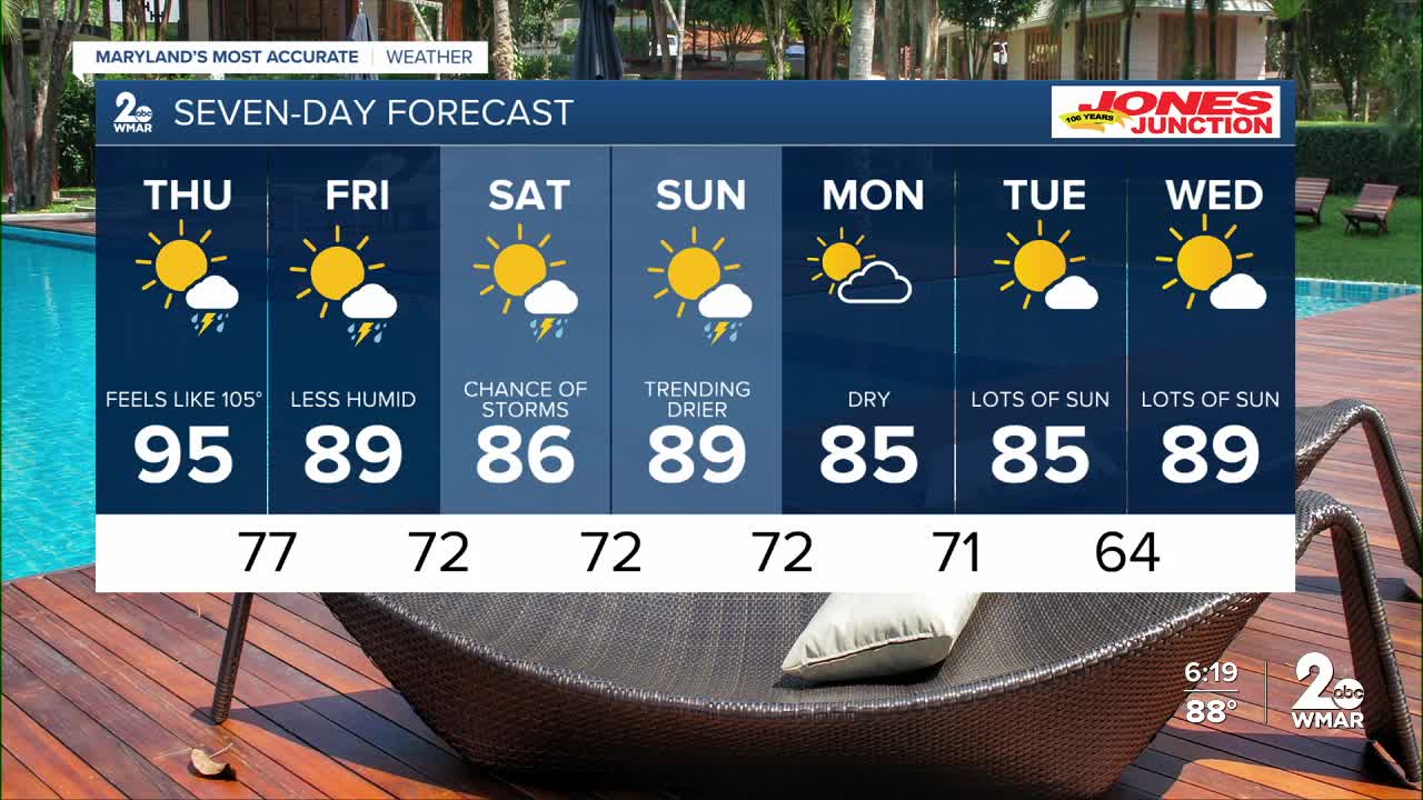


BALTIMORE — New weather data suggests Thu-Sun is trending drier! The main weather story Thursday will be the extreme heat! Temps surge to 95° with a feels like temp of 105-108°F! A cool front slides through late Thursday, which will lower the humidity as we head into the weekend!

7 Day Forecast:
Thursday A slight chance of showers and thunderstorms. Mostly sunny, with a high near 95. Heat index values as high as 104.
Thursday Night A chance of showers and thunderstorms. Partly cloudy, with a low around 77.
Friday A chance of showers and thunderstorms. Partly sunny, with a high near 89.
Friday Night A chance of showers and thunderstorms. Mostly cloudy, with a low around 72.
Saturday A chance of showers. Partly sunny, with a high near 86.
Saturday Night A chance of showers and thunderstorms. Mostly cloudy, with a low around 72.
Sunday A chance of showers and possibly a thunderstorm. Partly sunny, with a high near 89.
Sunday Night Showers and thunderstorms likely. Mostly cloudy, with a low around 72.
Monday A chance of showers and thunderstorms. Mostly sunny, with a high near 86.
Monday Night A chance of showers and thunderstorms. Mostly cloudy, with a low around 71.
Tuesday A chance of showers and thunderstorms. Partly sunny, with a high near 85.
Tuesday Night A chance of showers. Partly sunny, with a low around 64.
Wednesday A chance of showers and thunderstorms. Partly cloudy, with a high near 83.

