


BALTIMORE — Good Tuesday evening!
Periods of heavy rain are expected overnight, with most of the rain wrapping up before 5 a.m. Wednesday. Wednesday will be slightly drier, but still overcast, with areas of dense fog and a few spotty showers possible.
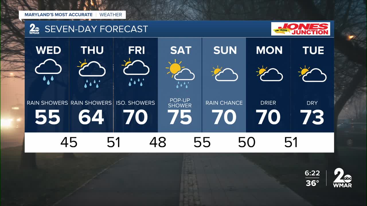
Looking ahead, a big warm-up arrives late in the week and into the weekend! Highs climb into the mid-70s, and for some perspective—the average high this time of year is around 50°. That puts us about 25 degrees above normal.


7 Day Forecast:
Wednesday A chance of rain. Patchy fog. Otherwise, cloudy, with a high near 56.
Wednesday Night Rain likely. Cloudy, with a low around 46.
Thursday A chance of showers. Mostly cloudy, with a high near 64.
Thursday Night Showers likely. Mostly cloudy, with a low around 51.
Friday A chance of showers. Partly sunny, with a high near 70.
Friday Night Mostly cloudy, with a low around 47.
Saturday Partly sunny, with a high near 71.
Saturday Night A chance of showers. Mostly cloudy, with a low around 55.
Sunday A chance of showers. Mostly cloudy, with a high near 71.
Sunday Night A chance of showers. Mostly cloudy, with a low around 53.
Monday A chance of showers. Partly sunny, with a high near 72.
Monday Night Partly cloudy, with a low around 57.
Tuesday Mostly sunny, with a high near 75.

