


BALTIMORE — Good Thursday night!
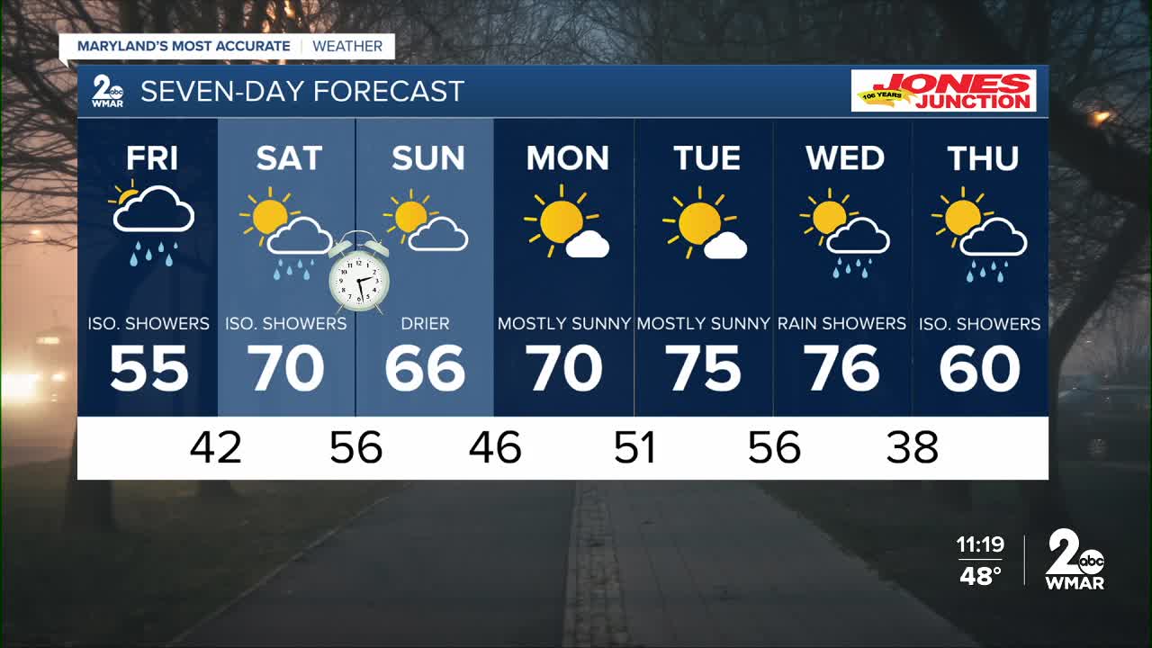
You can expect another night of scattered showers along with dense fog. The rain will be gone by daybreak Friday, but overcast skies linger through the afternoon. There may be a pop-up shower or two Friday afternoon, but we're not expecting widespread heavy rain. A secondary front slides through Saturday, bringing with it a few quick showers. As of now, Sunday is the pick of the weekend, with more sunshine and drier conditions! Next week starts dry on Monday, with showers returning towards the second half of the week!
Brighter days are ahead, just be patient!
Dylan

7 Day Forecast:
Friday Isolated showers. Patchy fog. Otherwise, mostly cloudy, with a high near 57.
Friday Night A slight chance of showers. Otherwise, mostly cloudy, with a low around 42.
Saturday Mostly cloudy, with a high near 70.
Saturday Night Showers likely. Mostly cloudy, with a low around 56.
Sunday Mostly cloudy, with a high near 66.
Sunday Night Partly cloudy, with a low around 46.
Monday Mostly sunny, with a high near 67.
Monday Night Partly cloudy, with a low around 51.
Tuesday Mostly sunny, with a high near 73.
Tuesday Night Partly cloudy, with a low around 56.
Wednesday A chance of showers. Partly sunny, with a high near 76.
Wednesday Night Showers likely. Mostly cloudy, with a low around 38.
Thursday A chance of showers. Mostly cloudy, with a high near 58.

