


BALTIMOREE — Hello! I'm meteorologist Dylan Robichaud here with your Wednesday evening forecast.
Here's a brief synopsis of what we're tracking over the next few days...
• Wildfire smoke will worsen Wednesday night as winds bring in wildfire smoke from Canada.
• Sunshine returns Thursday (although it'll be windy!)
• Perseid Meteor Shower peaks next week!
Low clouds will keep your Wednesday night gray. Our high resolution forecast models show these low clouds burning off Thursday morning, allowing for the return of the sunshine.
The one nuisance Thursday will be the wind. It won't be windy in the morning, but east winds will increase to 15-20 mph in the afternoon!
These same east winds will be responsible for an increase in wildfire smoke. The majority of the smoke is high in the atmosphere, however, it may mix down to the surface from time to time. Those sensitive to poor air quality should use caution.
The weekend looks phenomenal with sunshine both days and temps in the 80s.
Small house keeping note, but the Perseid Meteor Shower peaks next week Aug 12/13. I expect rather clear skies, however, the moon will be 86% full - which may hinder viewing!
Have a good one!
Dylan

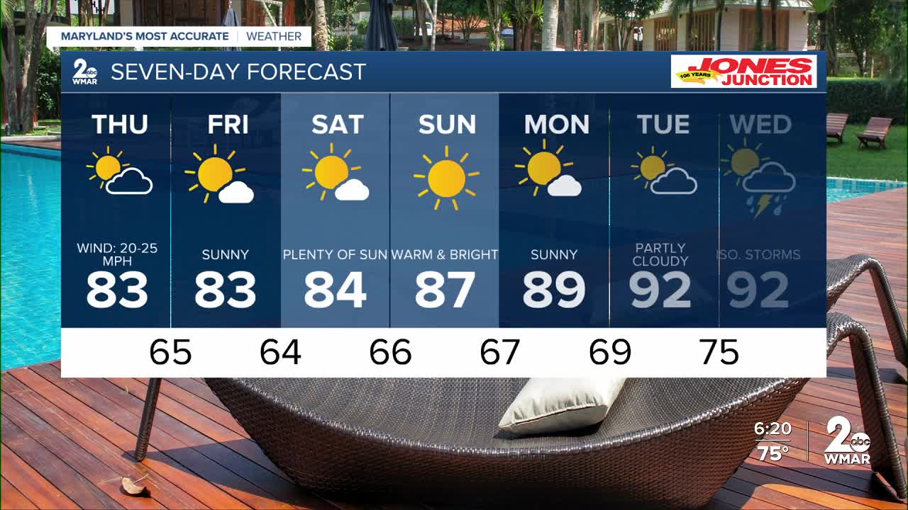
7 Day Forecast:
Thursday Partly cloudy, with a high near 83. Winds gusting to 20 mph.
Thursday Night Mostly clear, with a low around 65.
Friday Mostly sunny, with a high near 83.
Friday Night Mostly clear, with a low around 64.
Saturday Mostly sunny, with a high near 84.
Saturday Night Mostly clear, with a low around 66.
Sunday Sunny, with a high near 87.
Sunday Night Partly cloudy, with a low around 67.
Monday Mostly sunny, with a high near 89.
Monday Night Partly cloudy, with a low around 69.
Tuesday Partly cloudy, with a high near 92.
Tuesday Night Partly cloudy, with a low around 75.
Wednesday A chance of showers and thunderstorms. Mostly sunny, with a high near 92.

