


BALTIMORE — Winter Weather Advisories go into effect at 1 PM Sunday - 1 AM Monday for areas north and west of the Bay.
Models show the snow moving in a bit earlier, around 2 PM Sunday afternoon with snowfall rates of 1-2" per hour with more organized snow banding.
This is the time when snow will accumulate. It looks like the quick changeover from snow to freezing rain/sleet mix occurs around 9 PM along I-95.
A transition from freezing rain/sleet to cold rain will take place before midnight and precipitation overnight into early Monday will mainly fall in the form of liquid rain (moderate-heavy at times).
Higher snowfall totals are still projected to be north and west of the city. Snowfall totals decrease greatly south and east of I-95 as rain will be lingering over the southern end of the Eastern Shore for a longer duration. Winds will turn gusty Sunday evening - Monday, upwards of 45 mph at times. Some leftover flurries/sleet/light rain showers are possible around daybreak Monday which may create additional slick spots. Drier midday Monday.
More tranquil weather prevails for Tuesday with slightly below average temperatures. Trending milder for Wednesday and winds will remain on the elevated side through late week.
Stay Tuned!

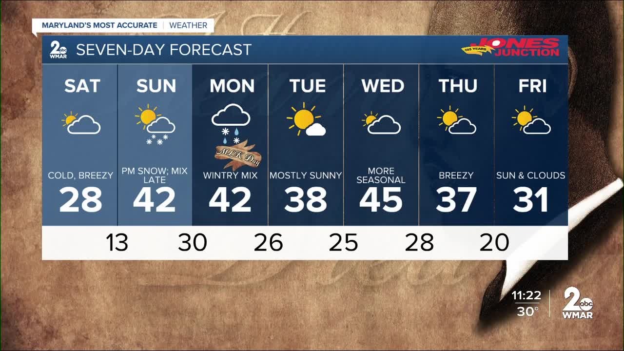
7 Day Forecast:
Today Increasing clouds, with a high near 28. North wind 9 to 13 mph, with gusts as high as 20 mph.
Tonight Cloudy during the early evening, then gradual clearing, with a low around 14. North wind 3 to 7 mph.
Sunday Snow, mainly after 4pm. High near 35. Northeast wind 5 to 13 mph. Chance of precipitation is 80%. New snow accumulation of around an inch possible.
Sunday Night Rain and snow before 10pm, then rain between 10pm and 4am, then rain likely, possibly mixed with snow after 4am. Low around 29. Northeast wind 14 to 18 mph becoming south after midnight. Winds could gust as high as 31 mph. Chance of precipitation is 100%. New snow accumulation of around an inch possible.
M.L.King Day A chance of rain, snow, and freezing rain before 10am, then a slight chance of rain and snow between 10am and 1pm. Mostly cloudy, with a high near 41. Breezy, with a west wind 13 to 21 mph, with gusts as high as 31 mph. Chance of precipitation is 40%.
Monday Night Mostly cloudy, with a low around 26. Breezy.
Tuesday Sunny, with a high near 38.
Tuesday Night Partly cloudy, with a low around 23.
Wednesday Mostly cloudy, with a high near 45.
Wednesday Night Mostly cloudy, with a low around 28.
Thursday Partly sunny, with a high near 36.
Thursday Night Mostly cloudy, with a low around 19.
Friday Partly sunny, with a high near 31.

