

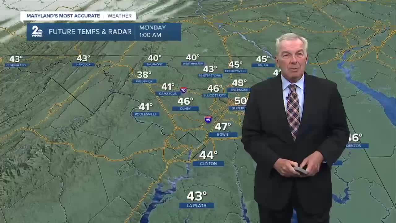

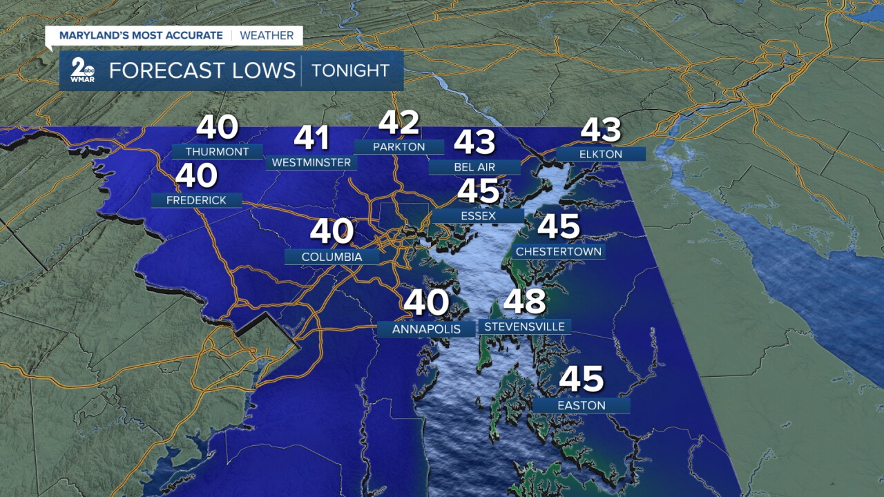
BALTIMORE — Cooler weather is on tap overnight. Our skies will be fair, and that will allow for the lows to fall back into the upper 30s well west of the city and the lower to middle 40s downtown.
Sunday will turn into a very nice day for us. You will get to enjoy ample amounts of sunshine with just a fair-weather cloud or two popping up in the afternoon. Highs will be in the lower to middle 60s.
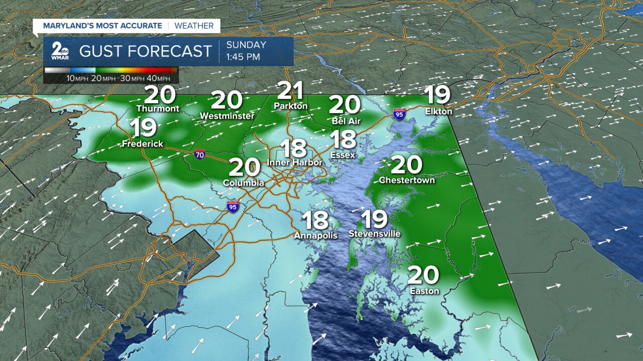
Once again, the weather will be a little gusty for the afternoon, with wind gusts of 20-25 miles possible.
Back to work on Monday and the early part of next week looks calm and quiet. You can expect to see mainly clear skies and mild temperatures. We will have a pair of dry cold fronts that will pass through here.
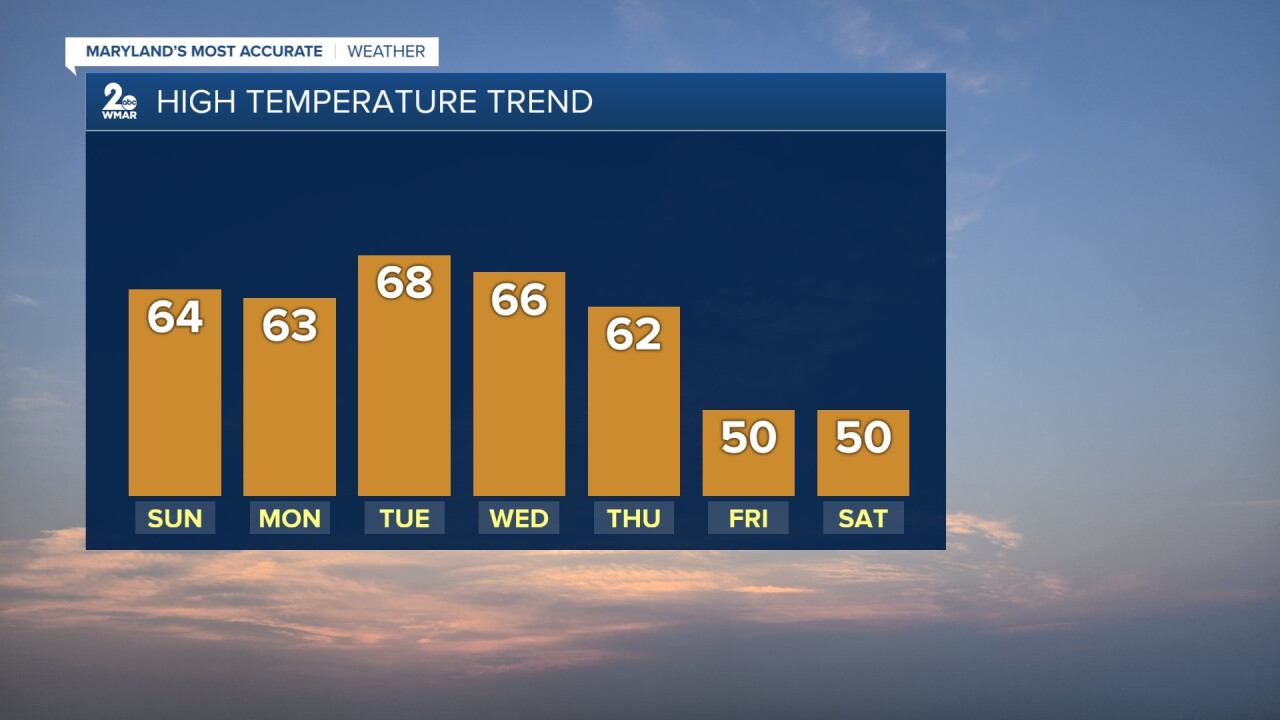
The result of that will be a return to some slightly milder air with highs in the mid to upper 60s. On Tuesday we will see highs possibly near70 degrees in a few spots south of us.
However, things are going to change by the end of the week. The upper-level winds (around 18,000 feet) are going to change into a pattern that will drive lots of cold air into the eastern part of the nation.
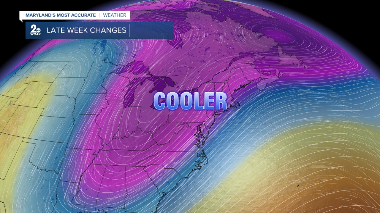
This will cause a storm to develop for the East Coast in the Thursday night to Saturday time frame. Remember, this is something that does not exist yet, which makes the future path hard to determine!
But right now, it looks like a cold rain will develop for us late Thursday night and into Friday.
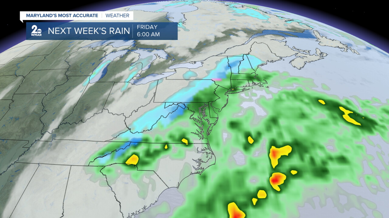
Some of the models indicate a pool of cold air t hat could yield some wet snow at higher elevations (above 3,000 feet) in the mountains out to the west. Time will tell.

