


BALTIMORE — Good Monday evening!
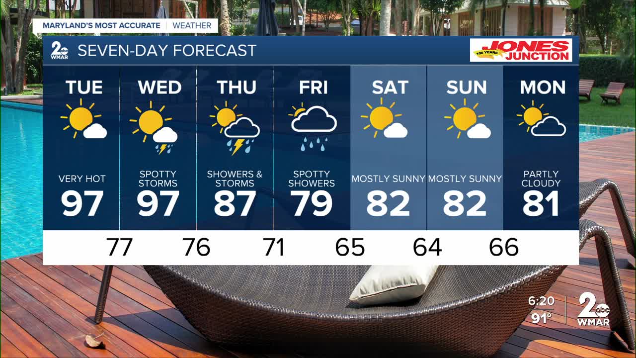
Extreme heat will be the top story Tuesday and Wednesday with highs around 97° and dew points in the upper 60s, making for a "feels like" forecast of 100-105°!
The heat finally breaks on Wednesday, as a cold front slides through the region, allowing temps to drop a little bit.

Storm chances return to the area Wednesday, but will most likely remain over the mountainous regions of western Maryland.
Shower chances move farther east on Thursday - encompassing most of our area! Preliminary rainfall estimates show we could see a half inch to an inch of rain on Thursday.
Showers linger on Friday morning, then we dry out by midday.
Lets talk about the weekend - we are looking at sunshine with temps in the low 80s and low humidity!

7 Day Forecast:
Tuesday Sunny and hot, with a high near 97. Heat index values as high as 101.
Tuesday Night Mostly clear, with a low around 77.
Wednesday A slight chance of showers and thunderstorms. Mostly sunny and hot, with a high near 99.
Wednesday Night A chance of showers and thunderstorms. Mostly cloudy, with a low around 76.
Thursday A chance of showers and thunderstorms. High near 90.
Thursday Night Showers and possibly a thunderstorm. Low around 71.
Friday A chance of showers. Mostly cloudy, with a high near 81.
Friday Night Partly cloudy, with a low around 65.
Saturday Sunny, with a high near 84.
Saturday Night Mostly clear, with a low around 64.
Sunday Sunny, with a high near 82.
Sunday Night Mostly clear, with a low around 66.
Monday Mostly sunny, with a high near 81.

