


BALTIMORE — Happy Monday!
Mostly cloudy skies today with highs hovering near the freezing mark! A storm system tracks to our south, possibly bringing a few flurries to our southern communities. A surge of Arctic air is set to deliver Maryland’s coldest night of the season thus far tonight. A spotty showers or two is possible on Wednesday, with a brief warm up mid-week! As of right now, there is plenty of uncertainty with the potential for a wintry mix later this week. Skies will be dry this weekend.

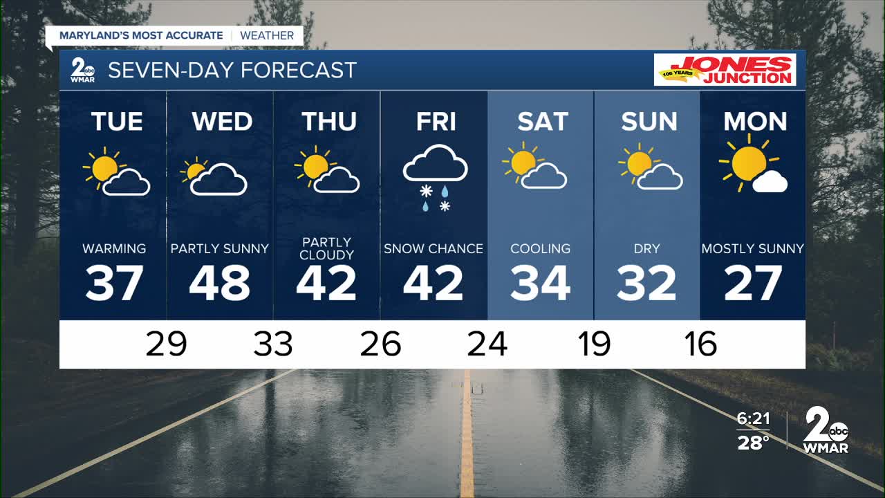
7 Day Forecast:
Today A slight chance of snow. Cloudy, with a high near 32. Northeast wind 5-15 mph, with gusts as high as 25 mph.
Tonight Cloudy during the early evening, then gradual clearing, with a low around 18.
Tuesday Partly cloudy, with a high near 37.
Tuesday Night Mostly cloudy, with a low around 29.
Wednesday A chance of rain. Mostly cloudy, with a high near 48.
Wednesday Night Partly cloudy, with a low around 33.
Thursday Partly cloudy, with a high near 42.
Thursday Night Mostly cloudy, with a low around 26.
Friday Partly sunny, with a high near 42.
Friday Night A chance of rain and snow. Mostly cloudy, with a low around 24.
Saturday Partly cloudy, with a high near 34.
Saturday Night Partly cloudy, with a low around 19.
Sunday Partly cloudy, with a high near 32.
Sunday Night Mostly clear, with a low around 16.
Monday Mostly sunny, with a high near 27.

